
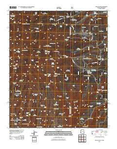
~ Maple Peak AZ topo map, 1:24000 scale, 7.5 X 7.5 Minute, Historical, 2011
Maple Peak, Arizona, USGS topographic map dated 2011.
Includes geographic coordinates (latitude and longitude). This topographic map is suitable for hiking, camping, and exploring, or framing it as a wall map.
Printed on-demand using high resolution imagery, on heavy weight and acid free paper, or alternatively on a variety of synthetic materials.
Topos available on paper, Waterproof, Poly, or Tyvek. Usually shipping rolled, unless combined with other folded maps in one order.
- Product Number: USGS-5246013
- Free digital map download (high-resolution, GeoPDF): Maple Peak, Arizona (file size: 22 MB)
- Map Size: please refer to the dimensions of the GeoPDF map above
- Weight (paper map): ca. 55 grams
- Map Type: POD USGS Topographic Map
- Map Series: US Topo
- Map Verison: Historical
- Cell ID: 27591
- Datum: North American Datum of 1983
- Map Projection: Transverse Mercator
- Map Cell Name: Maple Peak
- Grid size: 7.5 X 7.5 Minute
- Date on map: 2011
- Map Scale: 1:24000
- Geographical region: Arizona, United States
Neighboring Maps:
All neighboring USGS topo maps are available for sale online at a variety of scales.
Spatial coverage:
Topo map Maple Peak, Arizona, covers the geographical area associated the following places:
- Banjo Tank - Morris Gap - One Horn Corral - One Horn Tank - Dry Prong Tank - Oak Spring - Bullard Spring - Arizona Spring - Rincon Flats - Liza Tank - Rattlesnake Spring - Copperas Spring - Upper Oak Spring - Kelly Wells Spring - Pot Tank - Judy Tank - Citizen Spring - One Horn Canyon - Wildbunch Trailhead - Hells Hole Tank - Apple Orchard Spring - Gavilan Peak - Brand Tree Canyon Tank - Bullard Peak - Webster Hole Tank - Webster Canyon - East Snare SPring - Hobo Number Two Tank - South Buzzard Tank - Powerline Tank - Oak Springs Canyon - One Horn Canyon - Charlies Spring - Bullard Canyon - Grassy Mountain Tank - Wavy Spring - Lower Oak Spring - Buzzard Branch Tank - Maple Corral - Smoothing Iron Mesa - Maple Spring - Indian Creek Spring - North Side Pine Corral - Indian Spring - Coalson Tank - Citizen Tank - Nine Tank - Webster Mountain - Horse Canyon Trail Thirty-six - Center Tank - Buchanan Tank - Webster Spring - Jay Tank - Devils Den Canyon - Maple Peak Tank - High Tank - Coalson Ranch - Short Tank - Gavilan Number One Spring - Morris Gap Corral - Gavilan Spring - Stateline Water Storage Tank - Steep Canyon Tank - Fox Corral - Charlie Moore Trailhead - Snare Mesa - Coalson Peak - Anderson Tank - Snare Spring - Smoothing Iron Tank - No Permit Tank - Porky Canyon Spring - Petmaker Canyon - Two-Fork Spring - Bullard Corral - Deer Springs Canyon - Blue Tank - Do Nothing Canyon - Wild Bunch Trick Tank - Rattlesnake Canyon - Upper Oak Spring - Bull Run Canyon - Salt Ground Tank - Gavilan Corral - Copperas Tank - Cookstove Tank - Vigil Tank - Pen Canyon Springs - Steep Tank - Cookstove Corral - Lower Indian Corral - J Lazy H Mesa - Upper Pine Spring - Corner Tank - Tributary Spring - Pop Top Spring - Smoothing Iron Camp - Maple Tank - Bear Spring - Coalson Mesa
- Map Area ID: AREA33.37533.25-109.125-109
- Northwest corner Lat/Long code: USGSNW33.375-109.125
- Northeast corner Lat/Long code: USGSNE33.375-109
- Southwest corner Lat/Long code: USGSSW33.25-109.125
- Southeast corner Lat/Long code: USGSSE33.25-109
- Northern map edge Latitude: 33.375
- Southern map edge Latitude: 33.25
- Western map edge Longitude: -109.125
- Eastern map edge Longitude: -109


