
~ Luna Lake AZ topo map, 1:24000 scale, 7.5 X 7.5 Minute, Historical, 2011
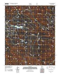
Luna Lake, Arizona, USGS topographic map dated 2011.
Includes geographic coordinates (latitude and longitude). This topographic map is suitable for hiking, camping, and exploring, or framing it as a wall map.
Printed on-demand using high resolution imagery, on heavy weight and acid free paper, or alternatively on a variety of synthetic materials.
Topos available on paper, Waterproof, Poly, or Tyvek. Usually shipping rolled, unless combined with other folded maps in one order.
- Product Number: USGS-5246011
- Free digital map download (high-resolution, GeoPDF): Luna Lake, Arizona (file size: 20 MB)
- Map Size: please refer to the dimensions of the GeoPDF map above
- Weight (paper map): ca. 55 grams
- Map Type: POD USGS Topographic Map
- Map Series: US Topo
- Map Verison: Historical
- Cell ID: 26955
- Datum: North American Datum of 1983
- Map Projection: Transverse Mercator
- Map Cell Name: Luna Lake
- Grid size: 7.5 X 7.5 Minute
- Date on map: 2011
- Map Scale: 1:24000
- Geographical region: Arizona, United States
Neighboring Maps:
All neighboring USGS topo maps are available for sale online at a variety of scales.
Spatial coverage:
Topo map Luna Lake, Arizona, covers the geographical area associated the following places:
- Little Meadow Spring - Alpine Country Club - Double J Ranch - Rincon Spring - Pumpkin Spring - Luna Tank - Dry Blue Creek - Trap Tank - Hamblin Tank - Upper Homestead Spring - Arroyo Tank - South Mountain Tank - High Clark Canyon - Jackson Tank - Tenney Meadow Spring - Bob Thomas Creek - Terry Tank - Cambern - Booth Hollow Spring - Little Creek Tank - Indian Peak - Cat Tank - Lower Ke Spring - Frisco Spring - Camp Cienega Spring - K E Spring - Section Line Tank - Hy Clark Draw - High Clark Spring - Carmen Spring Number One - White Tail Spring - Luna Dam - Upper Road Cienega Spring - White Bluff - Alpine Forest Service Facility - Alpine Country CLub Tank - Camp Cienega Tank - Estes Tank - Upper Tenney Spring - Hy Clark Spring - Road Cienega Spring - Stanford Spring - Trap Spring - Jackson Creek - Long Cienega - Luna Lake Group Campground - Prime Lake - Indian Tank - Crossing Spring - Tenney Pond - Cotton Flat - Tenney Tank - Luna Lake Marina - Little Creek - Engineer Spring - Forth Spring - Cameron Spring Number Two - Brown Tank - Trap Spring - Luna Lake Boat Launch - Lower Little Creek Spring - Little Jackson Spring - Dump Flat Spring - Adair Tank - Luna Lake Campground - Little Spring - Alpine First Baptist Church - Hall Tank - Stone Creek - Booth Hollow Tank - Jackson Spring - Canyon Creek Tank - Dump Tank - Luna Lake - Alpine Timber Camp - Skousen Spring - Engineer Tank - Fence Line Spring - Juniper Bench - Fork Tank - Luna Lake Well - Upper Long Cienega Spring
- Map Area ID: AREA33.87533.75-109.125-109
- Northwest corner Lat/Long code: USGSNW33.875-109.125
- Northeast corner Lat/Long code: USGSNE33.875-109
- Southwest corner Lat/Long code: USGSSW33.75-109.125
- Southeast corner Lat/Long code: USGSSE33.75-109
- Northern map edge Latitude: 33.875
- Southern map edge Latitude: 33.75
- Western map edge Longitude: -109.125
- Eastern map edge Longitude: -109


