
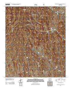
~ Whiterock Mountain NM topo map, 1:24000 scale, 7.5 X 7.5 Minute, Historical, 2011
Whiterock Mountain, New Mexico, USGS topographic map dated 2011.
Includes geographic coordinates (latitude and longitude). This topographic map is suitable for hiking, camping, and exploring, or framing it as a wall map.
Printed on-demand using high resolution imagery, on heavy weight and acid free paper, or alternatively on a variety of synthetic materials.
Topos available on paper, Waterproof, Poly, or Tyvek. Usually shipping rolled, unless combined with other folded maps in one order.
- Product Number: USGS-5245433
- Free digital map download (high-resolution, GeoPDF): Whiterock Mountain, New Mexico (file size: 26 MB)
- Map Size: please refer to the dimensions of the GeoPDF map above
- Weight (paper map): ca. 55 grams
- Map Type: POD USGS Topographic Map
- Map Series: US Topo
- Map Verison: Historical
- Cell ID: 48829
- Datum: North American Datum of 1983
- Map Projection: Transverse Mercator
- Map Cell Name: Whiterock Mountain
- Grid size: 7.5 X 7.5 Minute
- Date on map: 2011
- Map Scale: 1:24000
- Geographical region: New Mexico, United States
Neighboring Maps:
All neighboring USGS topo maps are available for sale online at a variety of scales.
Spatial coverage:
Topo map Whiterock Mountain, New Mexico, covers the geographical area associated the following places:
- Fuller Canyon - Log Spring - Parks Ranch - Mule Springs Peak - Taylor Canyon - Indian Springs Canyon - Bear Springs Windmill - Whiterock Mountain - Taylor Spring - F Latham Ranch - Little Bear Springs - South Taylor Canyon - Walnut Spring - N Latham Ranch - Outlaw Canyon - Taylor Tank - T Latham Ranch - The Seep Spring - Lightfoot Well - Lee Mountain - Road Canyon - McAsh Spring - Taylor Canyon - Indian Spring - North Hollow Creek - Taylor Creek - Log Springs Mountain - Grapevine Spring - Taylor Well - Alkali Canyon - Macho Well - Booth Ranch - Alkali Spring - Pollock Creek
- Map Area ID: AREA32.7532.625-107.75-107.625
- Northwest corner Lat/Long code: USGSNW32.75-107.75
- Northeast corner Lat/Long code: USGSNE32.75-107.625
- Southwest corner Lat/Long code: USGSSW32.625-107.75
- Southeast corner Lat/Long code: USGSSE32.625-107.625
- Northern map edge Latitude: 32.75
- Southern map edge Latitude: 32.625
- Western map edge Longitude: -107.75
- Eastern map edge Longitude: -107.625


