
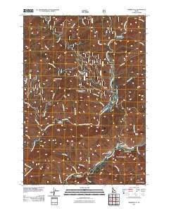
~ Barber Flat ID topo map, 1:24000 scale, 7.5 X 7.5 Minute, Historical, 2011
Barber Flat, Idaho, USGS topographic map dated 2011.
Includes geographic coordinates (latitude and longitude). This topographic map is suitable for hiking, camping, and exploring, or framing it as a wall map.
Printed on-demand using high resolution imagery, on heavy weight and acid free paper, or alternatively on a variety of synthetic materials.
Topos available on paper, Waterproof, Poly, or Tyvek. Usually shipping rolled, unless combined with other folded maps in one order.
- Product Number: USGS-5244756
- Free digital map download (high-resolution, GeoPDF): Barber Flat, Idaho (file size: 24 MB)
- Map Size: please refer to the dimensions of the GeoPDF map above
- Weight (paper map): ca. 55 grams
- Map Type: POD USGS Topographic Map
- Map Series: US Topo
- Map Verison: Historical
- Cell ID: 2379
- Datum: North American Datum of 1983
- Map Projection: Transverse Mercator
- Map Cell Name: Barber Flat
- Grid size: 7.5 X 7.5 Minute
- Date on map: 2011
- Map Scale: 1:24000
- Geographical region: Idaho, United States
Neighboring Maps:
All neighboring USGS topo maps are available for sale online at a variety of scales.
Spatial coverage:
Topo map Barber Flat, Idaho, covers the geographical area associated the following places:
- Dobson Gulch - Pool Creek - Idaho Outdoor Assn Campground - Second Creek - Blind Creek - Big Five Creek - Don Creek - Meadow Creek - Beaver Creek - Sacrifice Creek - Rabbit Creek - Wren Creek - First Creek - Plantation Creek - Alexander Flats - Fire Creek - Hungarian Ridge - Ninemeyer Creek - Corral Creek - Simmons Creek - Lost Creek - Crooked River - Boise Mountains - Tin Cup Creek - Short Creek - Camp Creek - Alexander Creek - Ninemeyer Campground - Barber Flat - Black Rock Campground - Hungarian Creek - Wood Creek - Weatherby Landing Area (historical) - Barber Flat Forest Service Station - Road Creek
- Map Area ID: AREA43.87543.75-115.625-115.5
- Northwest corner Lat/Long code: USGSNW43.875-115.625
- Northeast corner Lat/Long code: USGSNE43.875-115.5
- Southwest corner Lat/Long code: USGSSW43.75-115.625
- Southeast corner Lat/Long code: USGSSE43.75-115.5
- Northern map edge Latitude: 43.875
- Southern map edge Latitude: 43.75
- Western map edge Longitude: -115.625
- Eastern map edge Longitude: -115.5


