
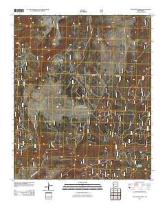
~ Slaughter Mesa NM topo map, 1:24000 scale, 7.5 X 7.5 Minute, Historical, 2011
Slaughter Mesa, New Mexico, USGS topographic map dated 2011.
Includes geographic coordinates (latitude and longitude). This topographic map is suitable for hiking, camping, and exploring, or framing it as a wall map.
Printed on-demand using high resolution imagery, on heavy weight and acid free paper, or alternatively on a variety of synthetic materials.
Topos available on paper, Waterproof, Poly, or Tyvek. Usually shipping rolled, unless combined with other folded maps in one order.
- Product Number: USGS-5244489
- Free digital map download (high-resolution, GeoPDF): Slaughter Mesa, New Mexico (file size: 26 MB)
- Map Size: please refer to the dimensions of the GeoPDF map above
- Weight (paper map): ca. 55 grams
- Map Type: POD USGS Topographic Map
- Map Series: US Topo
- Map Verison: Historical
- Cell ID: 41670
- Datum: North American Datum of 1983
- Map Projection: Transverse Mercator
- Map Cell Name: Slaughter Mesa
- Grid size: 7.5 X 7.5 Minute
- Date on map: 2011
- Map Scale: 1:24000
- Geographical region: New Mexico, United States
Neighboring Maps:
All neighboring USGS topo maps are available for sale online at a variety of scales.
Spatial coverage:
Topo map Slaughter Mesa, New Mexico, covers the geographical area associated the following places:
- San Antone Tank - McKibben Tank - Caballeriza Tank - Chimenea Spring - Dead Horse Canyon - Largo Canyon Tank - Caballeriza Spring - Jacobs Camp Tank - Lost Cabin Well - Cat Spring Tank - Cassidera Spring - East Tank - Verde Spring - El Caso Lookout - Bull Tank - Continental Tank - Cat Spring - El Caso Lake - Green Tank - Divide Tank - Fire Tank - Indio Canyon Tank - Lake Pit - Chimenea Canyon - Lobo Tank - Cooper Seep Spring - Salvador Spring - Elk Tank - Antelope Tank - North Tank - Slaughter Mesa - Dry Lake Well - Slaughter Mesa Tank - Hell Hole Tank - Salvador Canyon - Leslie Spring - Twin Springs - Largo Canyon - Mangas Mountains - Lyles Camp Spring - Mestenio Tank - Bluestem Tank - Gooseberry Pit - Leslie Spring Trail
- Map Area ID: AREA34.12534-108.5-108.375
- Northwest corner Lat/Long code: USGSNW34.125-108.5
- Northeast corner Lat/Long code: USGSNE34.125-108.375
- Southwest corner Lat/Long code: USGSSW34-108.5
- Southeast corner Lat/Long code: USGSSE34-108.375
- Northern map edge Latitude: 34.125
- Southern map edge Latitude: 34
- Western map edge Longitude: -108.5
- Eastern map edge Longitude: -108.375


