
~ Wilson Mountain NM topo map, 1:24000 scale, 7.5 X 7.5 Minute, Historical, 2011
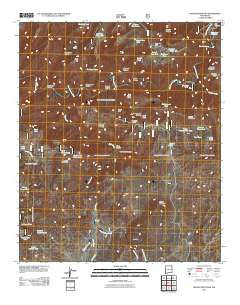
Wilson Mountain, New Mexico, USGS topographic map dated 2011.
Includes geographic coordinates (latitude and longitude). This topographic map is suitable for hiking, camping, and exploring, or framing it as a wall map.
Printed on-demand using high resolution imagery, on heavy weight and acid free paper, or alternatively on a variety of synthetic materials.
Topos available on paper, Waterproof, Poly, or Tyvek. Usually shipping rolled, unless combined with other folded maps in one order.
- Product Number: USGS-5244447
- Free digital map download (high-resolution, GeoPDF): Wilson Mountain, New Mexico (file size: 25 MB)
- Map Size: please refer to the dimensions of the GeoPDF map above
- Weight (paper map): ca. 55 grams
- Map Type: POD USGS Topographic Map
- Map Series: US Topo
- Map Verison: Historical
- Cell ID: 49338
- Datum: North American Datum of 1983
- Map Projection: Transverse Mercator
- Map Cell Name: Wilson Mountain
- Grid size: 7.5 X 7.5 Minute
- Date on map: 2011
- Map Scale: 1:24000
- Geographical region: New Mexico, United States
Neighboring Maps:
All neighboring USGS topo maps are available for sale online at a variety of scales.
Spatial coverage:
Topo map Wilson Mountain, New Mexico, covers the geographical area associated the following places:
- Cottonwood Canyon - Zumwalt Ranch - Cat Claw Tank - Lower Ant Spring - Snow Peak - Sawmill Creek - Lightning Mesa - Pothole Canyon - Pasture Tank - Table Top - Goat Basin Canyon - Water Development Tank - San Francisco Hot Springs - Jeep Tank - Rough Tank - Cave Canyon - Ditch Tank - Big Dry Creek - Outlaw Mountain - Saddle Tank - The Box - Drift Fence Tank - Turkey Basin Tank - Buckhorn Tank - East Tank - Angel Roost - Table Top Spring - Cottonwood Canyon - Sipes Spring - West Ant Tank - Juniper Flat - Park Tank Number Two - Cottonwood Tank - Ant Spring Canyon - Lollipop Tank - Pine Cienega Creek - Sunflower Tank - Section Three Tank - Antelope Flat - Squirrel Canyon - Branding Tree Spring - Upper Sipes Spring - Lightning Mesa Tank - Brandy Tree Tank - Gorilla Spring - Back of Pasture Tank - Blacktail Tanks - West Masonry Tank - Frisco Hot Springs - Ringtail Canyon - Cat Spring - Box Tank - Upper Drift Fence Tank - Rock Tank - Big Pasture Tank - Ant Spring - Potholes Country - Lower Pasture Tank - Henry Ranch - Mule Creek - Single Tree Tank - Wilson Mountain - Park Tank - Fence Tank - Sundial Mountain - Lower San Francisco Wilderness Study Area - Sipes Canyon - Juniper Flat Tanks - Tennessee Creek - Lost Grave Canyon - Hanna Mountain
- Map Area ID: AREA33.2533.125-109-108.875
- Northwest corner Lat/Long code: USGSNW33.25-109
- Northeast corner Lat/Long code: USGSNE33.25-108.875
- Southwest corner Lat/Long code: USGSSW33.125-109
- Southeast corner Lat/Long code: USGSSE33.125-108.875
- Northern map edge Latitude: 33.25
- Southern map edge Latitude: 33.125
- Western map edge Longitude: -109
- Eastern map edge Longitude: -108.875


