
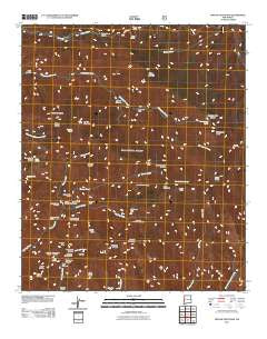
~ Grouse Mountain NM topo map, 1:24000 scale, 7.5 X 7.5 Minute, Historical, 2011
Grouse Mountain, New Mexico, USGS topographic map dated 2011.
Includes geographic coordinates (latitude and longitude). This topographic map is suitable for hiking, camping, and exploring, or framing it as a wall map.
Printed on-demand using high resolution imagery, on heavy weight and acid free paper, or alternatively on a variety of synthetic materials.
Topos available on paper, Waterproof, Poly, or Tyvek. Usually shipping rolled, unless combined with other folded maps in one order.
- Product Number: USGS-5244403
- Free digital map download (high-resolution, GeoPDF): Grouse Mountain, New Mexico (file size: 28 MB)
- Map Size: please refer to the dimensions of the GeoPDF map above
- Weight (paper map): ca. 55 grams
- Map Type: POD USGS Topographic Map
- Map Series: US Topo
- Map Verison: Historical
- Cell ID: 18645
- Datum: North American Datum of 1983
- Map Projection: Transverse Mercator
- Map Cell Name: Grouse Mountain
- Grid size: 7.5 X 7.5 Minute
- Date on map: 2011
- Map Scale: 1:24000
- Geographical region: New Mexico, United States
Neighboring Maps:
All neighboring USGS topo maps are available for sale online at a variety of scales.
Spatial coverage:
Topo map Grouse Mountain, New Mexico, covers the geographical area associated the following places:
- Spruce Creek - Hanging Rock Trail - Sandy Point - Upper Little Dry Creek Working - Bead Spring - Center Baldy - Bursum Recreation Site - Cold Spring - Apache Spring - Winn Canyon - Black Mountain Spring - Camp Creek - Packsaddle Canyon - Gold Bar - Silver Creek Divide - Queens Crown - Redstone Park - Hummingbird Spring - Black Mountain - Maverick Prospect - Simmons Saddle - Upper Big Dry Creek Prospects - Apache Cabin - Grouse Mountain - Deloche Trail Prospects - Kings Crown - Rainstorm Canyon - Lipsey Canyon - New Eureka Adit - Mountain View Claim - Kirkpatrick Prospect - Windy Gap - Windy Point - Skeleton Ridge Trail - Whitewater Baldy - Royal Gorge Claim - Indian Peak - Spider Saddle - Willow Mountain - Rain Creek Divide Trail - Golden Link Cabin - Regal Adit - Western Big Dry Creek Property - Golden Link Trail - West Baldy - Spruce Creek Saddle - Hobo Spring - Spider Creek - Rainstorm Gulch Working - Rock Spring - Quartz Number One Prospect - Dog Canyon - Quartz Number Prospect - Pilgrim Camp Prospects - East Fork Trail - Dog Spring - Spruce Creek Workings - Deer Trail Tunnel - Hummingbird Saddle - Nabours Spring - California Park - Sacaton Mountain - Spruce Creek Cabin - Camp Creek Saddle - Uncle John Mine - Sacaton Mountain Trail - Silver Drip Trail
- Map Area ID: AREA33.37533.25-108.75-108.625
- Northwest corner Lat/Long code: USGSNW33.375-108.75
- Northeast corner Lat/Long code: USGSNE33.375-108.625
- Southwest corner Lat/Long code: USGSSW33.25-108.75
- Southeast corner Lat/Long code: USGSSE33.25-108.625
- Northern map edge Latitude: 33.375
- Southern map edge Latitude: 33.25
- Western map edge Longitude: -108.75
- Eastern map edge Longitude: -108.625


