
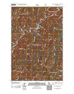
~ Huckleberry Butte ID topo map, 1:24000 scale, 7.5 X 7.5 Minute, Historical, 2011
Huckleberry Butte, Idaho, USGS topographic map dated 2011.
Includes geographic coordinates (latitude and longitude). This topographic map is suitable for hiking, camping, and exploring, or framing it as a wall map.
Printed on-demand using high resolution imagery, on heavy weight and acid free paper, or alternatively on a variety of synthetic materials.
Topos available on paper, Waterproof, Poly, or Tyvek. Usually shipping rolled, unless combined with other folded maps in one order.
- Product Number: USGS-5244247
- Free digital map download (high-resolution, GeoPDF): Huckleberry Butte, Idaho (file size: 25 MB)
- Map Size: please refer to the dimensions of the GeoPDF map above
- Weight (paper map): ca. 55 grams
- Map Type: POD USGS Topographic Map
- Map Series: US Topo
- Map Verison: Historical
- Cell ID: 21343
- Datum: North American Datum of 1983
- Map Projection: Transverse Mercator
- Map Cell Name: Huckleberry Butte
- Grid size: 7.5 X 7.5 Minute
- Date on map: 2011
- Map Scale: 1:24000
- Geographical region: Idaho, United States
Neighboring Maps:
All neighboring USGS topo maps are available for sale online at a variety of scales.
Spatial coverage:
Topo map Huckleberry Butte, Idaho, covers the geographical area associated the following places:
- Snowshoe Creek - Lone Knob Creek - Wilderness Gateway Pack Bridge - Sherman Creek - No-see-um Creek - Pass Creek - Lottie Lake - Grit Creek - Boulder Flat - Sardine Creek - Boulder Creek - Lochsa Historical Station - Huckleberry Creek - Lochsa Work Center - Big Stew Creek - Rock Lake Creek - Five Island - West Fork Boulder Creek - Lone Knob - Cantaloupe Creek - Beaver Flat - Lochsa Peak - Otter Slide Creek - Bee Creek - Pondosa Creek - Fish Creek - Maude Lake - Dipper Creek - Old Man Point - Stanley Hot Springs - Pagoda Creek - Huckleberry Butte - Eel Creek
- Map Area ID: AREA46.37546.25-115.375-115.25
- Northwest corner Lat/Long code: USGSNW46.375-115.375
- Northeast corner Lat/Long code: USGSNE46.375-115.25
- Southwest corner Lat/Long code: USGSSW46.25-115.375
- Southeast corner Lat/Long code: USGSSE46.25-115.25
- Northern map edge Latitude: 46.375
- Southern map edge Latitude: 46.25
- Western map edge Longitude: -115.375
- Eastern map edge Longitude: -115.25


