
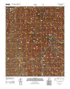
~ Vicks Peak NM topo map, 1:24000 scale, 7.5 X 7.5 Minute, Historical, 2011
Vicks Peak, New Mexico, USGS topographic map dated 2011.
Includes geographic coordinates (latitude and longitude). This topographic map is suitable for hiking, camping, and exploring, or framing it as a wall map.
Printed on-demand using high resolution imagery, on heavy weight and acid free paper, or alternatively on a variety of synthetic materials.
Topos available on paper, Waterproof, Poly, or Tyvek. Usually shipping rolled, unless combined with other folded maps in one order.
- Product Number: USGS-5243053
- Free digital map download (high-resolution, GeoPDF): Vicks Peak, New Mexico (file size: 27 MB)
- Map Size: please refer to the dimensions of the GeoPDF map above
- Weight (paper map): ca. 55 grams
- Map Type: POD USGS Topographic Map
- Map Series: US Topo
- Map Verison: Historical
- Cell ID: 46868
- Datum: North American Datum of 1983
- Map Projection: Transverse Mercator
- Map Cell Name: Vicks Peak
- Grid size: 7.5 X 7.5 Minute
- Date on map: 2011
- Map Scale: 1:24000
- Geographical region: New Mexico, United States
Neighboring Maps:
All neighboring USGS topo maps are available for sale online at a variety of scales.
Spatial coverage:
Topo map Vicks Peak, New Mexico, covers the geographical area associated the following places:
- Weir Tank - Oak Spring - Lower Holdup Tank - Shipman Spring - Wild Horse Canyon - Myers Spring - Biscuit Knob - Nave Canyon - Whitetail Tank - San Mateo Peak - Summit Mine - Whitetail Spring - Cooks Cabin - Frank Well - Myers Cabin - Rock Head Dam Tank - Villa Nerce Spring - Vicks Peak - Rhyolite Mine - Shipman Tank - Turkey Spring - Frank Tank - Crest Trail - Rock Spring - San Mateo Spring - Luna Park - Corn Canyon - Cowboy Trail - Milo Canyon - Shipman Cabin - Smith Canyon - Priest Mine - San Mateo Mountain - Upper Holdup Tank - Springtime Campground - La Madera Well - Holdup Canyon - Luna Park Tank - Casa Grande - Spruce Park - Rock Springs Canyon - Nave Spring
- Map Area ID: AREA33.62533.5-107.5-107.375
- Northwest corner Lat/Long code: USGSNW33.625-107.5
- Northeast corner Lat/Long code: USGSNE33.625-107.375
- Southwest corner Lat/Long code: USGSSW33.5-107.5
- Southeast corner Lat/Long code: USGSSE33.5-107.375
- Northern map edge Latitude: 33.625
- Southern map edge Latitude: 33.5
- Western map edge Longitude: -107.5
- Eastern map edge Longitude: -107.375


