
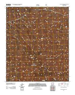
~ Blue Mountain NM topo map, 1:24000 scale, 7.5 X 7.5 Minute, Historical, 2011
Blue Mountain, New Mexico, USGS topographic map dated 2011.
Includes geographic coordinates (latitude and longitude). This topographic map is suitable for hiking, camping, and exploring, or framing it as a wall map.
Printed on-demand using high resolution imagery, on heavy weight and acid free paper, or alternatively on a variety of synthetic materials.
Topos available on paper, Waterproof, Poly, or Tyvek. Usually shipping rolled, unless combined with other folded maps in one order.
- Product Number: USGS-5243023
- Free digital map download (high-resolution, GeoPDF): Blue Mountain, New Mexico (file size: 29 MB)
- Map Size: please refer to the dimensions of the GeoPDF map above
- Weight (paper map): ca. 55 grams
- Map Type: POD USGS Topographic Map
- Map Series: US Topo
- Map Verison: Historical
- Cell ID: 4534
- Datum: North American Datum of 1983
- Map Projection: Transverse Mercator
- Map Cell Name: Blue Mountain
- Grid size: 7.5 X 7.5 Minute
- Date on map: 2011
- Map Scale: 1:24000
- Geographical region: New Mexico, United States
Neighboring Maps:
All neighboring USGS topo maps are available for sale online at a variety of scales.
Spatial coverage:
Topo map Blue Mountain, New Mexico, covers the geographical area associated the following places:
- Drift Fence Canyon - Alexander Spring - Apache Kid Grave Site - Coffee Pot Canyon - Tool Box Spring - Allen Spring Canyon - Old Hidden Spring - West Fork Cold Spring Canyon - Cyclone Saddle - Black Mountain - Bull Canyon - Drift Fence Well - Apache Kid Peak - Hidden Springs Canyon - Holdup Mountain - Turkey Springs - Cow Trap Spring - Skeleton Ridge - East Red Well - San Mateo Mountains - Hardscrabble Spring - Bull Springs - Yellow Jacket Canyon - Cave Peaks - Pothole Spring - Twentyfive Yard Spring - Indian Spring - Blue Mountain - Bull Saddle - Teepee Peak - Cub Spring - Indian Creek - West Blue Mountain - Hidden Spring - Milligan Peak - Apache Kid Wilderness - Water Canyon - Cold Spring - Magdalena Ranger District
- Map Area ID: AREA33.7533.625-107.5-107.375
- Northwest corner Lat/Long code: USGSNW33.75-107.5
- Northeast corner Lat/Long code: USGSNE33.75-107.375
- Southwest corner Lat/Long code: USGSSW33.625-107.5
- Southeast corner Lat/Long code: USGSSE33.625-107.375
- Northern map edge Latitude: 33.75
- Southern map edge Latitude: 33.625
- Western map edge Longitude: -107.5
- Eastern map edge Longitude: -107.375


