
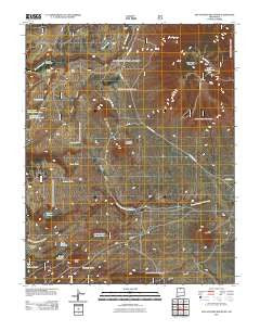
~ San Antonio Mountain NM topo map, 1:24000 scale, 7.5 X 7.5 Minute, Historical, 2011
San Antonio Mountain, New Mexico, USGS topographic map dated 2011.
Includes geographic coordinates (latitude and longitude). This topographic map is suitable for hiking, camping, and exploring, or framing it as a wall map.
Printed on-demand using high resolution imagery, on heavy weight and acid free paper, or alternatively on a variety of synthetic materials.
Topos available on paper, Waterproof, Poly, or Tyvek. Usually shipping rolled, unless combined with other folded maps in one order.
- Product Number: USGS-5243005
- Free digital map download (high-resolution, GeoPDF): San Antonio Mountain, New Mexico (file size: 20 MB)
- Map Size: please refer to the dimensions of the GeoPDF map above
- Weight (paper map): ca. 55 grams
- Map Type: POD USGS Topographic Map
- Map Series: US Topo
- Map Verison: Historical
- Cell ID: 71505
- Datum: North American Datum of 1983
- Map Projection: Transverse Mercator
- Map Cell Name: San Antonio Mountain
- Grid size: 7.5 X 7.5 Minute
- Date on map: 2011
- Map Scale: 1:24000
- Geographical region: New Mexico, United States
Neighboring Maps:
All neighboring USGS topo maps are available for sale online at a variety of scales.
Spatial coverage:
Topo map San Antonio Mountain, New Mexico, covers the geographical area associated the following places:
- Ursulo Lake - Felipe Tank - Malette Canyon - Corner Tank Number Two - San Antonio Tank - San Antonio Mountain - Montoya Canyon - Bean Patch Tank - Lamy Peak - Game Department Tank - Aquaje Tank - T-Bone Ranch - Cisneros Park - Salin Tank - Lower San Antone Tank - Stewart Corral - Bean Patch Tank Number One - Red Hill - Los Cerritos De La Cruz - Lucero Lakes - Pole Corral - Lucero Tank - Stanley Tank - South Cisneros - North Cisneros - Meadow Tank - Lamy Canyon - Los Cerritos De La Cruz
- Map Area ID: AREA36.87536.75-106.125-106
- Northwest corner Lat/Long code: USGSNW36.875-106.125
- Northeast corner Lat/Long code: USGSNE36.875-106
- Southwest corner Lat/Long code: USGSSW36.75-106.125
- Southeast corner Lat/Long code: USGSSE36.75-106
- Northern map edge Latitude: 36.875
- Southern map edge Latitude: 36.75
- Western map edge Longitude: -106.125
- Eastern map edge Longitude: -106


