
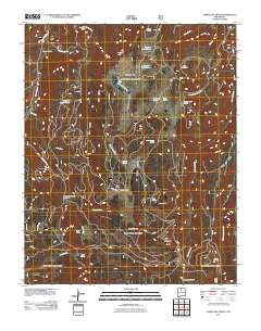
~ Cerro del Grant NM topo map, 1:24000 scale, 7.5 X 7.5 Minute, Historical, 2011
Cerro del Grant, New Mexico, USGS topographic map dated 2011.
Includes geographic coordinates (latitude and longitude). This topographic map is suitable for hiking, camping, and exploring, or framing it as a wall map.
Printed on-demand using high resolution imagery, on heavy weight and acid free paper, or alternatively on a variety of synthetic materials.
Topos available on paper, Waterproof, Poly, or Tyvek. Usually shipping rolled, unless combined with other folded maps in one order.
- Product Number: USGS-5242963
- Free digital map download (high-resolution, GeoPDF): Cerro del Grant, New Mexico (file size: 28 MB)
- Map Size: please refer to the dimensions of the GeoPDF map above
- Weight (paper map): ca. 55 grams
- Map Type: POD USGS Topographic Map
- Map Series: US Topo
- Map Verison: Historical
- Cell ID: 8015
- Datum: North American Datum of 1983
- Map Projection: Transverse Mercator
- Map Cell Name: Cerro del Grant
- Grid size: 7.5 X 7.5 Minute
- Date on map: 2011
- Map Scale: 1:24000
- Geographical region: New Mexico, United States
Neighboring Maps:
All neighboring USGS topo maps are available for sale online at a variety of scales.
Spatial coverage:
Topo map Cerro del Grant, New Mexico, covers the geographical area associated the following places:
- Barranquenos Spring - Cebolla Spring - Encino Lookout - Cerro Pelon - Pavo Spring - Mesa del Medio - Champe Tank - Valle de la Grulla - Upper Coyote Creek Sawmill - La Grulla Ranch - La Jara Spring - Laguna de los Pinos - Ojito Palo Duro - Cerro Pavo - Rito Seco - Cerro Valdez - Cañon del Coyote - Rey - Cerro del Grant - Magogo Tank - Mesa del Ojo - Leche Spring - Cañada de la Mora - Flavjo Spring - Madrid Spring - Laguna de la Grulla - Capulin Creek - Barrancones Creek - Rito Pelon - La Grulla Plateau - Laguna Madrid - Laguna de la Sierra - Mesa Lagunas - Grant Spring
- Map Area ID: AREA36.12536-106.625-106.5
- Northwest corner Lat/Long code: USGSNW36.125-106.625
- Northeast corner Lat/Long code: USGSNE36.125-106.5
- Southwest corner Lat/Long code: USGSSW36-106.625
- Southeast corner Lat/Long code: USGSSE36-106.5
- Northern map edge Latitude: 36.125
- Southern map edge Latitude: 36
- Western map edge Longitude: -106.625
- Eastern map edge Longitude: -106.5


