
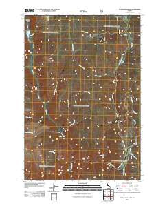
~ Silver Spur Ridge ID topo map, 1:24000 scale, 7.5 X 7.5 Minute, Historical, 2011
Silver Spur Ridge, Idaho, USGS topographic map dated 2011.
Includes geographic coordinates (latitude and longitude). This topographic map is suitable for hiking, camping, and exploring, or framing it as a wall map.
Printed on-demand using high resolution imagery, on heavy weight and acid free paper, or alternatively on a variety of synthetic materials.
Topos available on paper, Waterproof, Poly, or Tyvek. Usually shipping rolled, unless combined with other folded maps in one order.
- Product Number: USGS-5242275
- Free digital map download (high-resolution, GeoPDF): Silver Spur Ridge, Idaho (file size: 27 MB)
- Map Size: please refer to the dimensions of the GeoPDF map above
- Weight (paper map): ca. 55 grams
- Map Type: POD USGS Topographic Map
- Map Series: US Topo
- Map Verison: Historical
- Cell ID: 41410
- Datum: North American Datum of 1983
- Map Projection: Transverse Mercator
- Map Cell Name: Silver Spur Ridge
- Grid size: 7.5 X 7.5 Minute
- Date on map: 2011
- Map Scale: 1:24000
- Geographical region: Idaho, United States
Neighboring Maps:
All neighboring USGS topo maps are available for sale online at a variety of scales.
Spatial coverage:
Topo map Silver Spur Ridge, Idaho, covers the geographical area associated the following places:
- Lemon Creek - Halfway House Campground - Dixie Royal Mine - Fawn Creek - Big Creek Meadows - Calendar Canyon - Little Blowout Creek - Moose Meadow Creek - Big Creek Point - Nut Hill - Cape Horn - Whistling Pig Canyon - Jim Sandy Creek - Goldbug Mine - Big Creek - Pete Creek - Union Group Mines - McGuire Creek - Fish Lake - Gold Master Mine - Silver Spur Creek - Columbia Ridge - West Fork Big Creek - Eutopia Creek - Fawn Lake Creek - Power Creek - Herman Creek - Whistling Pig Creek - Eutopia Mine - Straight Creek - Hay Fork - Dixie USFS Airport - Dixie Work Center - Johnson Cabin - Hematite Mine - Jumbo Canyon - Silver Spur Ridge - Lake Creek
- Map Area ID: AREA45.62545.5-115.625-115.5
- Northwest corner Lat/Long code: USGSNW45.625-115.625
- Northeast corner Lat/Long code: USGSNE45.625-115.5
- Southwest corner Lat/Long code: USGSSW45.5-115.625
- Southeast corner Lat/Long code: USGSSE45.5-115.5
- Northern map edge Latitude: 45.625
- Southern map edge Latitude: 45.5
- Western map edge Longitude: -115.625
- Eastern map edge Longitude: -115.5


