
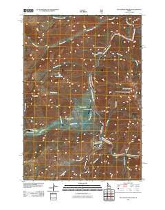
~ Big Soldier Mountain ID topo map, 1:24000 scale, 7.5 X 7.5 Minute, Historical, 2011
Big Soldier Mountain, Idaho, USGS topographic map dated 2011.
Includes geographic coordinates (latitude and longitude). This topographic map is suitable for hiking, camping, and exploring, or framing it as a wall map.
Printed on-demand using high resolution imagery, on heavy weight and acid free paper, or alternatively on a variety of synthetic materials.
Topos available on paper, Waterproof, Poly, or Tyvek. Usually shipping rolled, unless combined with other folded maps in one order.
- Product Number: USGS-5241451
- Free digital map download (high-resolution, GeoPDF): Big Soldier Mountain, Idaho (file size: 24 MB)
- Map Size: please refer to the dimensions of the GeoPDF map above
- Weight (paper map): ca. 55 grams
- Map Type: POD USGS Topographic Map
- Map Series: US Topo
- Map Verison: Historical
- Cell ID: 69350
- Datum: North American Datum of 1983
- Map Projection: Transverse Mercator
- Map Cell Name: Big Soldier Mountain
- Grid size: 7.5 X 7.5 Minute
- Date on map: 2011
- Map Scale: 1:24000
- Geographical region: Idaho, United States
Neighboring Maps:
All neighboring USGS topo maps are available for sale online at a variety of scales.
Spatial coverage:
Topo map Big Soldier Mountain, Idaho, covers the geographical area associated the following places:
- Morehead Creek - Cold Springs Campsite - Blue Moon Creek - Mine Creek - Rams Horn Creek - Dagger Creek - Dagger Falls - Boundary Creek - Patrol Creek - Sulphur Creek Ranch Airport - Sulphur Slide Rapid - Prospect Creek Trail - Trail Flat Campsite - Spike Creek - Velvet Creek - Big Bend Campsite - Elkhorn Creek - Middle Fork Elkhorn Creek - Morgan Ranch Airport - Sulphur Creek Ranch - Morehead Mountain - Prospect Creek - Boundary Creek Recreation Site - Blue Bunch Creek - Boy Scout Camp Campground - Sulphur Creek - Velvet Falls Campground - Lincoln Creek - Velvet Falls - Big Soldier Mountain - Gardells Campsite - Cable Hole Campsite - Morehead Lake - Dagger Falls Recreation Site
- Map Area ID: AREA44.62544.5-115.375-115.25
- Northwest corner Lat/Long code: USGSNW44.625-115.375
- Northeast corner Lat/Long code: USGSNE44.625-115.25
- Southwest corner Lat/Long code: USGSSW44.5-115.375
- Southeast corner Lat/Long code: USGSSE44.5-115.25
- Northern map edge Latitude: 44.625
- Southern map edge Latitude: 44.5
- Western map edge Longitude: -115.375
- Eastern map edge Longitude: -115.25


