
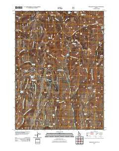
~ Mahogany Butte ID topo map, 1:24000 scale, 7.5 X 7.5 Minute, Historical, 2011
Mahogany Butte, Idaho, USGS topographic map dated 2011.
Includes geographic coordinates (latitude and longitude). This topographic map is suitable for hiking, camping, and exploring, or framing it as a wall map.
Printed on-demand using high resolution imagery, on heavy weight and acid free paper, or alternatively on a variety of synthetic materials.
Topos available on paper, Waterproof, Poly, or Tyvek. Usually shipping rolled, unless combined with other folded maps in one order.
- Product Number: USGS-5241313
- Free digital map download (high-resolution, GeoPDF): Mahogany Butte, Idaho (file size: 21 MB)
- Map Size: please refer to the dimensions of the GeoPDF map above
- Weight (paper map): ca. 55 grams
- Map Type: POD USGS Topographic Map
- Map Series: US Topo
- Map Verison: Historical
- Cell ID: 27263
- Datum: North American Datum of 1983
- Map Projection: Transverse Mercator
- Map Cell Name: Mahogany Butte
- Grid size: 7.5 X 7.5 Minute
- Date on map: 2011
- Map Scale: 1:24000
- Geographical region: Idaho, United States
Neighboring Maps:
All neighboring USGS topo maps are available for sale online at a variety of scales.
Spatial coverage:
Topo map Mahogany Butte, Idaho, covers the geographical area associated the following places:
- Cherry Creek - Buck Spring - Little Willow Creek - Joes Basin - Dry Fork Swanty Creek Spring - Swanty Spring - Crystal Spring - Little Piney Spring - Tub Spring - Trout Creek Pass Spring - W P A Spring - Thoroughbred Spring Number Two - Pine Tit - Red Bluff Spring - Kidd Spring - Cold Spring Canyon - Gravel Spring - Thoroughbred Pond Spring - Willow Creek - Humphrey Creek - Swanty Creek - Jay Creek Spring - Phantom Falls - Trout Creek Mountain - Trout Creek Pass - Water Canyon - Elk Basin Spring - Badger Gulch Spring - Trout Spring - Carlson Spring - Willow Creek Peak - Coldwater Spring - Joes Mountain - Badger Creek - Elk Basin Creek - Jay Creek Corral - Deerhorn Pass - Right Hand Fork Spring - Badger Gulch - West Fork Thoroughbred Creek - Dads Hump - Rim Rock Spring - Swanty Peak - Little Willow Spring - Thoroughbred Spring Number One - East Fork Thoroughbred Creek - Burn Spring - Humphrey Spring - Mahogany Butte - South Tit
- Map Area ID: AREA42.12542-114.25-114.125
- Northwest corner Lat/Long code: USGSNW42.125-114.25
- Northeast corner Lat/Long code: USGSNE42.125-114.125
- Southwest corner Lat/Long code: USGSSW42-114.25
- Southeast corner Lat/Long code: USGSSE42-114.125
- Northern map edge Latitude: 42.125
- Southern map edge Latitude: 42
- Western map edge Longitude: -114.25
- Eastern map edge Longitude: -114.125


