
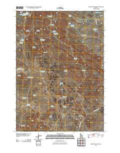
~ Summit Reservoir ID topo map, 1:24000 scale, 7.5 X 7.5 Minute, Historical, 2010
Summit Reservoir, Idaho, USGS topographic map dated 2010.
Includes geographic coordinates (latitude and longitude). This topographic map is suitable for hiking, camping, and exploring, or framing it as a wall map.
Printed on-demand using high resolution imagery, on heavy weight and acid free paper, or alternatively on a variety of synthetic materials.
Topos available on paper, Waterproof, Poly, or Tyvek. Usually shipping rolled, unless combined with other folded maps in one order.
- Product Number: USGS-5237566
- Free digital map download (high-resolution, GeoPDF): Summit Reservoir, Idaho (file size: 17 MB)
- Map Size: please refer to the dimensions of the GeoPDF map above
- Weight (paper map): ca. 55 grams
- Map Type: POD USGS Topographic Map
- Map Series: US Topo
- Map Verison: Historical
- Cell ID: 43757
- Datum: North American Datum of 1983
- Map Projection: Transverse Mercator
- Map Cell Name: Summit Reservoir
- Grid size: 7.5 X 7.5 Minute
- Date on map: 2010
- Map Scale: 1:24000
- Geographical region: Idaho, United States
Neighboring Maps:
All neighboring USGS topo maps are available for sale online at a variety of scales.
Spatial coverage:
Topo map Summit Reservoir, Idaho, covers the geographical area associated the following places:
- Jones Reservoir - Crater Reservoir - Spray Reservoir Number Two - Water Reservoir - Deadeye Reservoir - Border Reservoir - Crossroad Reservoir - One Hour Reservoir - Little Draw Reservoir - Tom Gooding Spring - Buck Brush Reservoir - Cirque Reservoir - Reserve Reservoir - Road Reservoir - Paddock Reservoir - Lone Rock Reservoir - Three Point Reservoir - Landmark Reservoir - Black Butte - Granite Butte Reservoir - Marsh Spring - Martin Reservoir - Fawn Reservoir - Wildcat Reservoir - Association Well - Flat Tire Reservoir - Shoshone Reservoir - Brailsford Well - Upper Seven-Hundred Reservoir - Deer Reservoir - Little Magic Reservoir - Choke Cherry Reservoir - Dry Wash Dam - Grante Butte Reservoir - Crossroad Reservoir - Bailing Reservoir - Darrah Reservoir - Summit Reservoir - Twin Reservoir - Chokecherry Reservoir - Daves Reservoir - Saddle Reservoir - Buckbrush Reservoir
- Map Area ID: AREA43.2543.125-114.5-114.375
- Northwest corner Lat/Long code: USGSNW43.25-114.5
- Northeast corner Lat/Long code: USGSNE43.25-114.375
- Southwest corner Lat/Long code: USGSSW43.125-114.5
- Southeast corner Lat/Long code: USGSSE43.125-114.375
- Northern map edge Latitude: 43.25
- Southern map edge Latitude: 43.125
- Western map edge Longitude: -114.5
- Eastern map edge Longitude: -114.375


