
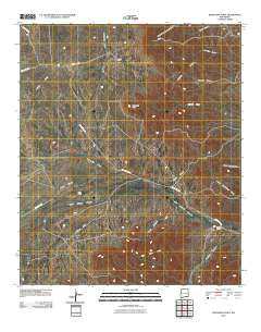
~ Bandanna Point NM topo map, 1:24000 scale, 7.5 X 7.5 Minute, Historical, 2010
Bandanna Point, New Mexico, USGS topographic map dated 2010.
Includes geographic coordinates (latitude and longitude). This topographic map is suitable for hiking, camping, and exploring, or framing it as a wall map.
Printed on-demand using high resolution imagery, on heavy weight and acid free paper, or alternatively on a variety of synthetic materials.
Topos available on paper, Waterproof, Poly, or Tyvek. Usually shipping rolled, unless combined with other folded maps in one order.
- Product Number: USGS-5234216
- Free digital map download (high-resolution, GeoPDF): Bandanna Point, New Mexico (file size: 25 MB)
- Map Size: please refer to the dimensions of the GeoPDF map above
- Weight (paper map): ca. 55 grams
- Map Type: POD USGS Topographic Map
- Map Series: US Topo
- Map Verison: Historical
- Cell ID: 2314
- Datum: North American Datum of 1983
- Map Projection: Transverse Mercator
- Map Cell Name: Bandanna Point
- Grid size: 7.5 X 7.5 Minute
- Date on map: 2010
- Map Scale: 1:24000
- Geographical region: New Mexico, United States
Neighboring Maps:
All neighboring USGS topo maps are available for sale online at a variety of scales.
Spatial coverage:
Topo map Bandanna Point, New Mexico, covers the geographical area associated the following places:
- 20102 Water Well - Callaway Well - Pipkin Well - 07011 Water Well - 20138 Water Well - Azotea Mesa - Moss Ranch - Walker Draw - S S Well - 20098 Water Well - Weldy Canyon - East Hess Hills - 20101 Water Well - China Canyon - Weldy Well - Callaway Ranch (historical) - 20099 Water Well - 20147 Water Well - 20100 Water Well - Russell Ranch - Johnson Canyon - 20139 Water Well - 20146 Water Well - Sotol Basin - Lower John Well - 20103 Water Well - Wooten Ranch - Pipkin Ranch (historical) - Bandanna Point - Wagontire Draw - Ward Ranch (historical)
- Map Area ID: AREA32.37532.25-104.625-104.5
- Northwest corner Lat/Long code: USGSNW32.375-104.625
- Northeast corner Lat/Long code: USGSNE32.375-104.5
- Southwest corner Lat/Long code: USGSSW32.25-104.625
- Southeast corner Lat/Long code: USGSSE32.25-104.5
- Northern map edge Latitude: 32.375
- Southern map edge Latitude: 32.25
- Western map edge Longitude: -104.625
- Eastern map edge Longitude: -104.5


