
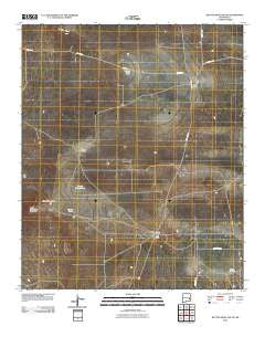
~ Button Mesa South NM topo map, 1:24000 scale, 7.5 X 7.5 Minute, Historical, 2010
Button Mesa South, New Mexico, USGS topographic map dated 2010.
Includes geographic coordinates (latitude and longitude). This topographic map is suitable for hiking, camping, and exploring, or framing it as a wall map.
Printed on-demand using high resolution imagery, on heavy weight and acid free paper, or alternatively on a variety of synthetic materials.
Topos available on paper, Waterproof, Poly, or Tyvek. Usually shipping rolled, unless combined with other folded maps in one order.
- Product Number: USGS-5231923
- Free digital map download (high-resolution, GeoPDF): Button Mesa South, New Mexico (file size: 22 MB)
- Map Size: please refer to the dimensions of the GeoPDF map above
- Weight (paper map): ca. 55 grams
- Map Type: POD USGS Topographic Map
- Map Series: US Topo
- Map Verison: Historical
- Cell ID: 6512
- Datum: North American Datum of 1983
- Map Projection: Transverse Mercator
- Map Cell Name: Button Mesa South
- Grid size: 7.5 X 7.5 Minute
- Date on map: 2010
- Map Scale: 1:24000
- Geographical region: New Mexico, United States
Neighboring Maps:
All neighboring USGS topo maps are available for sale online at a variety of scales.
Spatial coverage:
Topo map Button Mesa South, New Mexico, covers the geographical area associated the following places:
- Carroll Tub - Willow Wells - Drill Hole Twenty Gallon Well - 12509 Water Well - 12508 Water Well - U Bar Ranch - Punta Culebra de Cascade - Sweetwater Well - Plains Tank - East Sand Tank - White Tank - North Plains Tank - Lost Well - Antelope Tub - Lucky Strike Well - Fisher Windmill - 12513 Water Well - 12512 Water Well - Howell Well - Belcher Wells - East Plains Tank - 12510 Water Well - Bull Well - Cooper Ranch - 12511 Water Well - High Lonesome Windmill - KENW-TV (Portales) - Crowley Sand - 13371 Water Well
- Map Area ID: AREA33.62533.5-103.75-103.625
- Northwest corner Lat/Long code: USGSNW33.625-103.75
- Northeast corner Lat/Long code: USGSNE33.625-103.625
- Southwest corner Lat/Long code: USGSSW33.5-103.75
- Southeast corner Lat/Long code: USGSSE33.5-103.625
- Northern map edge Latitude: 33.625
- Southern map edge Latitude: 33.5
- Western map edge Longitude: -103.75
- Eastern map edge Longitude: -103.625


