
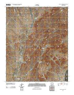
~ Wagon Canyon NM topo map, 1:24000 scale, 7.5 X 7.5 Minute, Historical, 2010
Wagon Canyon, New Mexico, USGS topographic map dated 2010.
Includes geographic coordinates (latitude and longitude). This topographic map is suitable for hiking, camping, and exploring, or framing it as a wall map.
Printed on-demand using high resolution imagery, on heavy weight and acid free paper, or alternatively on a variety of synthetic materials.
Topos available on paper, Waterproof, Poly, or Tyvek. Usually shipping rolled, unless combined with other folded maps in one order.
- Product Number: USGS-5231651
- Free digital map download (high-resolution, GeoPDF): Wagon Canyon, New Mexico (file size: 24 MB)
- Map Size: please refer to the dimensions of the GeoPDF map above
- Weight (paper map): ca. 55 grams
- Map Type: POD USGS Topographic Map
- Map Series: US Topo
- Map Verison: Historical
- Cell ID: 47133
- Datum: North American Datum of 1983
- Map Projection: Transverse Mercator
- Map Cell Name: Wagon Canyon
- Grid size: 7.5 X 7.5 Minute
- Date on map: 2010
- Map Scale: 1:24000
- Geographical region: New Mexico, United States
Neighboring Maps:
All neighboring USGS topo maps are available for sale online at a variety of scales.
Spatial coverage:
Topo map Wagon Canyon, New Mexico, covers the geographical area associated the following places:
- Panther Tank - Barnes Ranch - Butler Tank - Murray Well - Sixshooter Canyon - W H Shrum Tank - Juan Farmer Tank - Rentfro Well - Double Tank - Stark Tank - Lutz Canyon - Long Canyon - Taylor Canyon - Sand Tank - Pop Jackson Tank - North Water Well - Quail Canyon - M S Crockett Tank - Rentfro Junior Tank - Quail Tank - Sandy Tank - Sixshooter Tank - Rentfro Tank Number 2 - White Tank - Wagon Canyon - Walker Tank
- Map Area ID: AREA33.7533.625-106.125-106
- Northwest corner Lat/Long code: USGSNW33.75-106.125
- Northeast corner Lat/Long code: USGSNE33.75-106
- Southwest corner Lat/Long code: USGSSW33.625-106.125
- Southeast corner Lat/Long code: USGSSE33.625-106
- Northern map edge Latitude: 33.75
- Southern map edge Latitude: 33.625
- Western map edge Longitude: -106.125
- Eastern map edge Longitude: -106


