
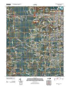
~ Greenville SW NC topo map, 1:24000 scale, 7.5 X 7.5 Minute, Historical, 2010
Greenville SW, North Carolina, USGS topographic map dated 2010.
Includes geographic coordinates (latitude and longitude). This topographic map is suitable for hiking, camping, and exploring, or framing it as a wall map.
Printed on-demand using high resolution imagery, on heavy weight and acid free paper, or alternatively on a variety of synthetic materials.
Topos available on paper, Waterproof, Poly, or Tyvek. Usually shipping rolled, unless combined with other folded maps in one order.
- Product Number: USGS-5230917
- Free digital map download (high-resolution, GeoPDF): Greenville SW, North Carolina (file size: 25 MB)
- Map Size: please refer to the dimensions of the GeoPDF map above
- Weight (paper map): ca. 55 grams
- Map Type: POD USGS Topographic Map
- Map Series: US Topo
- Map Verison: Historical
- Cell ID: 18471
- Datum: North American Datum of 1983
- Map Projection: Transverse Mercator
- Map Cell Name: Greenville SW
- Grid size: 7.5 X 7.5 Minute
- Date on map: 2010
- Map Scale: 1:24000
- Geographical region: North Carolina, United States
Neighboring Maps:
All neighboring USGS topo maps are available for sale online at a variety of scales.
Spatial coverage:
Topo map Greenville SW, North Carolina, covers the geographical area associated the following places:
- Hillsdale - Winterville - Rollingwood - Riverdale - Robinson Heights - Lincoln Park - Frog Level - Green Farm - Higgs - Bedford - Lake Ellsworth - Oakdale - Sedgefield - Lakewood Pines - Tucker Farms - Lynndale - Greyleigh - Belvedere - Biltmore - Lincoln Park - Clevewood - Weathington Heights - Treetops - Greenville Heights - Brentwood - Willoughby Condominiums - Red Oak - Paige - Williamsburg Manor North - Kearny Park - Carolina Heights - Village Grove - Baywood - Rochdale - Pinewood Forest - Westhaven - Dixons Crossroads - Sherwood Acres - Fairlane - Shamrock Terrace - Cannon Crossroads - Batts Court - Club Pines - Hines Crossroad - Renston - Cambridge - Evans Park - Canterbury - Devonshire Square - Candlewick Estates - Greenbrier - Summerfield - Westwood
- Map Area ID: AREA35.62535.5-77.5-77.375
- Northwest corner Lat/Long code: USGSNW35.625-77.5
- Northeast corner Lat/Long code: USGSNE35.625-77.375
- Southwest corner Lat/Long code: USGSSW35.5-77.5
- Southeast corner Lat/Long code: USGSSE35.5-77.375
- Northern map edge Latitude: 35.625
- Southern map edge Latitude: 35.5
- Western map edge Longitude: -77.5
- Eastern map edge Longitude: -77.375


