
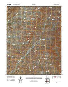
~ Adobe Downs Ranch NM topo map, 1:24000 scale, 7.5 X 7.5 Minute, Historical, 2010
Adobe Downs Ranch, New Mexico, USGS topographic map dated 2010.
Includes geographic coordinates (latitude and longitude). This topographic map is suitable for hiking, camping, and exploring, or framing it as a wall map.
Printed on-demand using high resolution imagery, on heavy weight and acid free paper, or alternatively on a variety of synthetic materials.
Topos available on paper, Waterproof, Poly, or Tyvek. Usually shipping rolled, unless combined with other folded maps in one order.
- Product Number: USGS-5230729
- Free digital map download (high-resolution, GeoPDF): Adobe Downs Ranch, New Mexico (file size: 27 MB)
- Map Size: please refer to the dimensions of the GeoPDF map above
- Weight (paper map): ca. 55 grams
- Map Type: POD USGS Topographic Map
- Map Series: US Topo
- Map Verison: Historical
- Cell ID: 206
- Datum: North American Datum of 1983
- Map Projection: Transverse Mercator
- Map Cell Name: Adobe Downs Ranch
- Grid size: 7.5 X 7.5 Minute
- Date on map: 2010
- Map Scale: 1:24000
- Geographical region: New Mexico, United States
Neighboring Maps:
All neighboring USGS topo maps are available for sale online at a variety of scales.
Spatial coverage:
Topo map Adobe Downs Ranch, New Mexico, covers the geographical area associated the following places:
- Camel Hump Dam - Martin Glade - Coyote Spring - New Mexico Mine - Painted Hills Dam - Oliver Dike - Zebra Hills Dam - North Light Plant Census Designated Place - Mosley Spring - Wilson Ranch - Vee Dam - Drip Pee Wee Dam - Dusenberry Glade - Pee Wee Dam - White Hill Dam - Jaquez Flat - Lawson Glade - Knob Rock Dam - McDermott Ditch - Hedges North Dam - Black Glade - Adobe Downs Ranch
- Map Area ID: AREA3736.875-108.125-108
- Northwest corner Lat/Long code: USGSNW37-108.125
- Northeast corner Lat/Long code: USGSNE37-108
- Southwest corner Lat/Long code: USGSSW36.875-108.125
- Southeast corner Lat/Long code: USGSSE36.875-108
- Northern map edge Latitude: 37
- Southern map edge Latitude: 36.875
- Western map edge Longitude: -108.125
- Eastern map edge Longitude: -108


