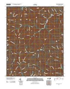
~ Luftee Knob NC topo map, 1:24000 scale, 7.5 X 7.5 Minute, Historical, 2010
Luftee Knob, North Carolina, USGS topographic map dated 2010.
Includes geographic coordinates (latitude and longitude). This topographic map is suitable for hiking, camping, and exploring, or framing it as a wall map.
Printed on-demand using high resolution imagery, on heavy weight and acid free paper, or alternatively on a variety of synthetic materials.
Topos available on paper, Waterproof, Poly, or Tyvek. Usually shipping rolled, unless combined with other folded maps in one order.
- Product Number: USGS-5229833
- Free digital map download (high-resolution, GeoPDF): Luftee Knob, North Carolina (file size: 31 MB)
- Map Size: please refer to the dimensions of the GeoPDF map above
- Weight (paper map): ca. 55 grams
- Map Type: POD USGS Topographic Map
- Map Series: US Topo
- Map Verison: Historical
- Cell ID: 26927
- Datum: North American Datum of 1983
- Map Projection: Transverse Mercator
- Map Cell Name: Luftee Knob
- Grid size: 7.5 X 7.5 Minute
- Date on map: 2010
- Map Scale: 1:24000
- Geographical region: North Carolina, United States
Neighboring Maps:
All neighboring USGS topo maps are available for sale online at a variety of scales.
Spatial coverage:
Topo map Luftee Knob, North Carolina, covers the geographical area associated the following places:
- Miller Branch - Mount Yonaguska - Cooks Creek - Grass Branch - Williamson Cemetery - Manse Branch - Yellow Creek Gap - Sugar Cove Campsite - Marks Knob - Falling Rock Creek - Hyatt Bald - Sunup Knob - Township of Cataloochee - Hyatt Ridge - Lost Bottom Creek - Luftee Knob - Trap Branch - Butt Mountain - Oskodah Branch - Ledge Bald - Laurel Gap Shelter - Camel Hump Mountain - Inadu Creek - Pretty Hollow Creek - Indian Ridge - Balsam High Top - Poplar Cove - Thumper Branch - Snakeden Mountain Campsite - Laurel Gap - John Mack Creek - Inadu Mountain - Beech Gap - Mc Gee Spring - Indian Knob - Thicket Branch - Bettis Branch - Table Rock Branch - Rough Mountain - Flint Rock Cove - Pin Oak Gap - Low Gap Branch - Camel Hump Creek - Mc Ginty Creek - Trail Ridge - Laurel Gap Branch - Swallow Fork - Good Spring Branch - Snake Den Mountain - Walnut Bottoms Cemetery - Camel Hump Knob - Thermo Branch - Pretty Hollow Gap - Balsam Mountain - Nettle Branch - Prophet Branch - Roses Gap - Chestnut Cove Creek - Shawano Ridge - Onion Bed Branch - Beech Creek - Dans Branch - Byrd Branch - Low Gap - Gray Camp Branch - Rocky Face Mountain - Slide Branch - Sevenmile Beech Ridge - Inadu Knob - Mount Hardison - Big Cataloochee Mountain - Yellow Creek - Turkey Pen Branch - Red Oak Cove - Brakeshoe Spring - Kilby Branch - Little Rock Creek - Thermo Knob - Cosby Knob - Lynn Camp Branch - Walnut Bottom - Kahneska Branch - Big Butt - Little Nettle Branch - Deer Creek - Rocky Branch - Dasohga Ridge - Mouse Creek - Ross Knob - Barnes Branch - Sinking Creek - Gunter Fork - Camel Gap - Mount Sterling Ridge - Balsam Corner Creek - Cosby Knob Shelter - Dry Branch - Big Head Branch - Balsam Corner - Roses Branch
- Map Area ID: AREA35.7535.625-83.25-83.125
- Northwest corner Lat/Long code: USGSNW35.75-83.25
- Northeast corner Lat/Long code: USGSNE35.75-83.125
- Southwest corner Lat/Long code: USGSSW35.625-83.25
- Southeast corner Lat/Long code: USGSSE35.625-83.125
- Northern map edge Latitude: 35.75
- Southern map edge Latitude: 35.625
- Western map edge Longitude: -83.25
- Eastern map edge Longitude: -83.125

