
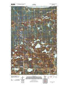
~ Bagley Lake MN topo map, 1:24000 scale, 7.5 X 7.5 Minute, Historical, 2010
Bagley Lake, Minnesota, USGS topographic map dated 2010.
Includes geographic coordinates (latitude and longitude). This topographic map is suitable for hiking, camping, and exploring, or framing it as a wall map.
Printed on-demand using high resolution imagery, on heavy weight and acid free paper, or alternatively on a variety of synthetic materials.
Topos available on paper, Waterproof, Poly, or Tyvek. Usually shipping rolled, unless combined with other folded maps in one order.
- Product Number: USGS-5227304
- Free digital map download (high-resolution, GeoPDF): Bagley Lake, Minnesota (file size: 23 MB)
- Map Size: please refer to the dimensions of the GeoPDF map above
- Weight (paper map): ca. 55 grams
- Map Type: POD USGS Topographic Map
- Map Series: US Topo
- Map Verison: Historical
- Cell ID: 2119
- Datum: North American Datum of 1983
- Map Projection: Transverse Mercator
- Map Cell Name: Bagley Lake
- Grid size: 7.5 X 7.5 Minute
- Date on map: 2010
- Map Scale: 1:24000
- Geographical region: Minnesota, United States
Neighboring Maps:
All neighboring USGS topo maps are available for sale online at a variety of scales.
Spatial coverage:
Topo map Bagley Lake, Minnesota, covers the geographical area associated the following places:
- Big Meadows Lookout Tower - Parks Lake - Pickerel Lake - Crooked Lake - Frisby Lake - Berg Lake - Johnson Lake - Pine Island Lake - Long Lake - Trinity Church - Camp Hiawatha - Bender Lake - Dunowen Post Office (historical) - Faith Chapel - Morrison Lake - Trinity Cemetery - Bagley Lake State Wildlife Management Area - Clover Cemetery - Graning Lake - Haggerty Lake - Fessland Lake - Mollison Lake - Moose Lake - Dunbar Lake - Fence Lake - Barr Lake - Stone Lake - Sand Lake - Big Rock Creek - Bagley Lake
- Map Area ID: AREA47.87547.75-95.25-95.125
- Northwest corner Lat/Long code: USGSNW47.875-95.25
- Northeast corner Lat/Long code: USGSNE47.875-95.125
- Southwest corner Lat/Long code: USGSSW47.75-95.25
- Southeast corner Lat/Long code: USGSSE47.75-95.125
- Northern map edge Latitude: 47.875
- Southern map edge Latitude: 47.75
- Western map edge Longitude: -95.25
- Eastern map edge Longitude: -95.125


