
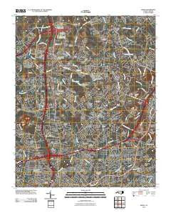
~ Derita NC topo map, 1:24000 scale, 7.5 X 7.5 Minute, Historical, 2010
Derita, North Carolina, USGS topographic map dated 2010.
Includes geographic coordinates (latitude and longitude). This topographic map is suitable for hiking, camping, and exploring, or framing it as a wall map.
Printed on-demand using high resolution imagery, on heavy weight and acid free paper, or alternatively on a variety of synthetic materials.
Topos available on paper, Waterproof, Poly, or Tyvek. Usually shipping rolled, unless combined with other folded maps in one order.
- Product Number: USGS-5226792
- Free digital map download (high-resolution, GeoPDF): Derita, North Carolina (file size: 26 MB)
- Map Size: please refer to the dimensions of the GeoPDF map above
- Weight (paper map): ca. 55 grams
- Map Type: POD USGS Topographic Map
- Map Series: US Topo
- Map Verison: Historical
- Cell ID: 12003
- Datum: North American Datum of 1983
- Map Projection: Transverse Mercator
- Map Cell Name: Derita
- Grid size: 7.5 X 7.5 Minute
- Date on map: 2010
- Map Scale: 1:24000
- Geographical region: North Carolina, United States
Neighboring Maps:
All neighboring USGS topo maps are available for sale online at a variety of scales.
Spatial coverage:
Topo map Derita, North Carolina, covers the geographical area associated the following places:
- Croft - Sunset Hills - Ridgeview - Joplor - University Place - Hunter Acres - Crater Park - Hampton Park - Greenbriar - Lynn Lee - Hyde Park Estates - Evergreen Park - Amarillo Park - Sugar Creek - Derita - Tryon Hills - Junker - Nevin - Fairfax Woods - Rockwell Park - Garden Park - Trexler Acres - Allen Hills - Atando Junction - Tanglewood - Virginia Manor - Knollwood Acres - Autumnwood - Green Meadows - Derita Woods - Bahama Park - Northwood - Hampshire Hills - Poplar Springs - Firestone - Druid Hills - Hidden Valley - Spring Lake - Hidden Valley Estates
- Map Area ID: AREA35.37535.25-80.875-80.75
- Northwest corner Lat/Long code: USGSNW35.375-80.875
- Northeast corner Lat/Long code: USGSNE35.375-80.75
- Southwest corner Lat/Long code: USGSSW35.25-80.875
- Southeast corner Lat/Long code: USGSSE35.25-80.75
- Northern map edge Latitude: 35.375
- Southern map edge Latitude: 35.25
- Western map edge Longitude: -80.875
- Eastern map edge Longitude: -80.75


