
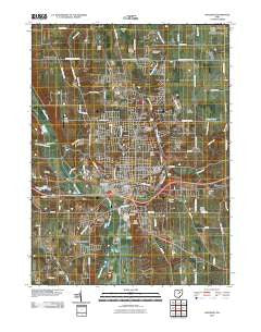
~ Wooster OH topo map, 1:24000 scale, 7.5 X 7.5 Minute, Historical, 2010
Wooster, Ohio, USGS topographic map dated 2010.
Includes geographic coordinates (latitude and longitude). This topographic map is suitable for hiking, camping, and exploring, or framing it as a wall map.
Printed on-demand using high resolution imagery, on heavy weight and acid free paper, or alternatively on a variety of synthetic materials.
Topos available on paper, Waterproof, Poly, or Tyvek. Usually shipping rolled, unless combined with other folded maps in one order.
- Product Number: USGS-5226072
- Free digital map download (high-resolution, GeoPDF): Wooster, Ohio (file size: 16 MB)
- Map Size: please refer to the dimensions of the GeoPDF map above
- Weight (paper map): ca. 55 grams
- Map Type: POD USGS Topographic Map
- Map Series: US Topo
- Map Verison: Historical
- Cell ID: 49871
- Datum: North American Datum of 1983
- Map Projection: Transverse Mercator
- Map Cell Name: Wooster
- Grid size: 7.5 X 7.5 Minute
- Date on map: 2010
- Map Scale: 1:24000
- Geographical region: Ohio, United States
Neighboring Maps:
All neighboring USGS topo maps are available for sale online at a variety of scales.
Spatial coverage:
Topo map Wooster, Ohio, covers the geographical area associated the following places:
- Burnetts Corners - Meadow Brook - Ramblewood - Christmas Run - Branstetter (historical) - Deer Creek - Madison Hill - Honeytown - Wooster - Wooster Trailer Park - Westwood - Melrose Village - Forest View Mobile Home Park - Madisonburg - Devil Town - Shel Mar Mobile Home Park - Highland Park - Boys Village - Mechanicsburg - Parkview - Miller Lakes - The Meadows - Art Smith Trailer Park - Forest Creek - Guerne - Linwood Heights - Sunset Trailer Park - Hillcrest - Spruce Tree Village
- Map Area ID: AREA40.87540.75-82-81.875
- Northwest corner Lat/Long code: USGSNW40.875-82
- Northeast corner Lat/Long code: USGSNE40.875-81.875
- Southwest corner Lat/Long code: USGSSW40.75-82
- Southeast corner Lat/Long code: USGSSE40.75-81.875
- Northern map edge Latitude: 40.875
- Southern map edge Latitude: 40.75
- Western map edge Longitude: -82
- Eastern map edge Longitude: -81.875


