
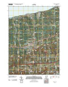
~ Geneva OH topo map, 1:24000 scale, 7.5 X 7.5 Minute, Historical, 2010
Geneva, Ohio, USGS topographic map dated 2010.
Includes geographic coordinates (latitude and longitude). This topographic map is suitable for hiking, camping, and exploring, or framing it as a wall map.
Printed on-demand using high resolution imagery, on heavy weight and acid free paper, or alternatively on a variety of synthetic materials.
Topos available on paper, Waterproof, Poly, or Tyvek. Usually shipping rolled, unless combined with other folded maps in one order.
- Product Number: USGS-5225388
- Free digital map download (high-resolution, GeoPDF): Geneva, Ohio (file size: 18 MB)
- Map Size: please refer to the dimensions of the GeoPDF map above
- Weight (paper map): ca. 55 grams
- Map Type: POD USGS Topographic Map
- Map Series: US Topo
- Map Verison: Historical
- Cell ID: 17039
- Datum: North American Datum of 1983
- Map Projection: Transverse Mercator
- Map Cell Name: Geneva
- Grid size: 7.5 X 7.5 Minute
- Date on map: 2010
- Map Scale: 1:24000
- Geographical region: Ohio, United States
Neighboring Maps:
All neighboring USGS topo maps are available for sale online at a variety of scales.
Spatial coverage:
Topo map Geneva, Ohio, covers the geographical area associated the following places:
- Buckeye Beach - Geneva-on-the-Lake - Geneva - Lakegrove Estates - Saybrook-on-the-lake - Harpersfield - Palmetto Beach - Profeta's Mobile Home Park - Woodmere - Mechanicsville - Normandy Village Mobile Home Park - Elmwood - Whispering Willows Mobile Home Park - Holdlen Hills - Grandview Park - Mapleton Beach
- Map Area ID: AREA41.87541.75-81-80.875
- Northwest corner Lat/Long code: USGSNW41.875-81
- Northeast corner Lat/Long code: USGSNE41.875-80.875
- Southwest corner Lat/Long code: USGSSW41.75-81
- Southeast corner Lat/Long code: USGSSE41.75-80.875
- Northern map edge Latitude: 41.875
- Southern map edge Latitude: 41.75
- Western map edge Longitude: -81
- Eastern map edge Longitude: -80.875


