
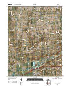
~ Donnelsville OH topo map, 1:24000 scale, 7.5 X 7.5 Minute, Historical, 2010
Donnelsville, Ohio, USGS topographic map dated 2010.
Includes geographic coordinates (latitude and longitude). This topographic map is suitable for hiking, camping, and exploring, or framing it as a wall map.
Printed on-demand using high resolution imagery, on heavy weight and acid free paper, or alternatively on a variety of synthetic materials.
Topos available on paper, Waterproof, Poly, or Tyvek. Usually shipping rolled, unless combined with other folded maps in one order.
- Product Number: USGS-5222930
- Free digital map download (high-resolution, GeoPDF): Donnelsville, Ohio (file size: 13 MB)
- Map Size: please refer to the dimensions of the GeoPDF map above
- Weight (paper map): ca. 55 grams
- Map Type: POD USGS Topographic Map
- Map Series: US Topo
- Map Verison: Historical
- Cell ID: 12545
- Datum: North American Datum of 1983
- Map Projection: Transverse Mercator
- Map Cell Name: Donnelsville
- Grid size: 7.5 X 7.5 Minute
- Date on map: 2010
- Map Scale: 1:24000
- Geographical region: Ohio, United States
Neighboring Maps:
All neighboring USGS topo maps are available for sale online at a variety of scales.
Spatial coverage:
Topo map Donnelsville, Ohio, covers the geographical area associated the following places:
- North Hampton - Anlo - Edgewood Mobile Home Park - Cedar Hills - Chateau Estates Mobile Home Park - Enon Mobile Home Park - Pleasant Valley Estates Mobile Home Park - Dodo - Donnelsville - Mad River - Shrine Road Mobile Home Park - Limestone City - Durbin - Lawrenceville - Hampton Woods - Enon - Lindair Acres - Enon Heights Mobile Home Park - Forgy - Karen Woods - Broadview Acres - Sycamore West - Windy Acres - Victoria Villa - Rock Way - Balentine Acres - Snyderville
- Map Area ID: AREA4039.875-84-83.875
- Northwest corner Lat/Long code: USGSNW40-84
- Northeast corner Lat/Long code: USGSNE40-83.875
- Southwest corner Lat/Long code: USGSSW39.875-84
- Southeast corner Lat/Long code: USGSSE39.875-83.875
- Northern map edge Latitude: 40
- Southern map edge Latitude: 39.875
- Western map edge Longitude: -84
- Eastern map edge Longitude: -83.875


