
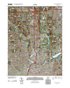
~ Dayton North OH topo map, 1:24000 scale, 7.5 X 7.5 Minute, Historical, 2010
Dayton North, Ohio, USGS topographic map dated 2010.
Includes geographic coordinates (latitude and longitude). This topographic map is suitable for hiking, camping, and exploring, or framing it as a wall map.
Printed on-demand using high resolution imagery, on heavy weight and acid free paper, or alternatively on a variety of synthetic materials.
Topos available on paper, Waterproof, Poly, or Tyvek. Usually shipping rolled, unless combined with other folded maps in one order.
- Product Number: USGS-5222822
- Free digital map download (high-resolution, GeoPDF): Dayton North, Ohio (file size: 20 MB)
- Map Size: please refer to the dimensions of the GeoPDF map above
- Weight (paper map): ca. 55 grams
- Map Type: POD USGS Topographic Map
- Map Series: US Topo
- Map Verison: Historical
- Cell ID: 11502
- Datum: North American Datum of 1983
- Map Projection: Transverse Mercator
- Map Cell Name: Dayton North
- Grid size: 7.5 X 7.5 Minute
- Date on map: 2010
- Map Scale: 1:24000
- Geographical region: Ohio, United States
Neighboring Maps:
All neighboring USGS topo maps are available for sale online at a variety of scales.
Spatial coverage:
Topo map Dayton North, Ohio, covers the geographical area associated the following places:
- Timberlane Mobile Village - Woods Mobile Home Park - Harries - Avondale Trailer Court - Sunny Acres Mobile Home Park - Shiloh - Hooks Corner - Dixie View Trailer Park - Woodland Hills Mobile Home Park - Avondale - Keenan Avenue Mobile Home Park - Daytonview - Spanker - Cornell Heights - Riverdale - North Riverdale - Taylorsville - Miami Villa - Valley Trailer Court - East Dayton - Shady Lawn Mobile Park - Murlin Heights - Drive In Mobile Home Park - Laws Mobile Home Park - Upper Dayton View - Fairview - Four Oaks Mobile Home Park - Dayton - Castlewood Trailer Court - Northridge
- Map Area ID: AREA39.87539.75-84.25-84.125
- Northwest corner Lat/Long code: USGSNW39.875-84.25
- Northeast corner Lat/Long code: USGSNE39.875-84.125
- Southwest corner Lat/Long code: USGSSW39.75-84.25
- Southeast corner Lat/Long code: USGSSE39.75-84.125
- Northern map edge Latitude: 39.875
- Southern map edge Latitude: 39.75
- Western map edge Longitude: -84.25
- Eastern map edge Longitude: -84.125


