
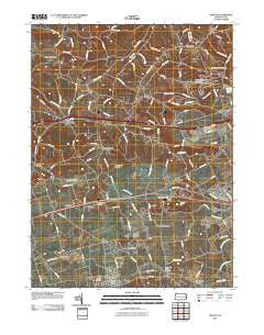
~ Topton PA topo map, 1:24000 scale, 7.5 X 7.5 Minute, Historical, 2010
Topton, Pennsylvania, USGS topographic map dated 2010.
Includes geographic coordinates (latitude and longitude). This topographic map is suitable for hiking, camping, and exploring, or framing it as a wall map.
Printed on-demand using high resolution imagery, on heavy weight and acid free paper, or alternatively on a variety of synthetic materials.
Topos available on paper, Waterproof, Poly, or Tyvek. Usually shipping rolled, unless combined with other folded maps in one order.
- Product Number: USGS-5220265
- Free digital map download (high-resolution, GeoPDF): Topton, Pennsylvania (file size: 12 MB)
- Map Size: please refer to the dimensions of the GeoPDF map above
- Weight (paper map): ca. 55 grams
- Map Type: POD USGS Topographic Map
- Map Series: US Topo
- Map Verison: Historical
- Cell ID: 45435
- Datum: North American Datum of 1983
- Map Projection: Transverse Mercator
- Map Cell Name: Topton
- Grid size: 7.5 X 7.5 Minute
- Date on map: 2010
- Map Scale: 1:24000
- Geographical region: Pennsylvania, United States
Neighboring Maps:
All neighboring USGS topo maps are available for sale online at a variety of scales.
Spatial coverage:
Topo map Topton, Pennsylvania, covers the geographical area associated the following places:
- Seiberlingville - Klines Corner - Hancock - Fogelsville - Monterey - Farmington - Topton - Ringtown - Weisenberg - Wallner (historical) - Shamrock Station - Newtown - Mill Creek Corner - Schofer - Mertztown - North Fogelsville - Hynemansville - Helfrichsville - Claussville - Breinigsville - Oreville - Hartzell (historical) - New Smithville - Five Points - Hinterleiter - Haafsville - Seipstown - Leather Corner Post - Maxatawny - Country View Mobile Home Park - Laros (historical)
- Map Area ID: AREA40.62540.5-75.75-75.625
- Northwest corner Lat/Long code: USGSNW40.625-75.75
- Northeast corner Lat/Long code: USGSNE40.625-75.625
- Southwest corner Lat/Long code: USGSSW40.5-75.75
- Southeast corner Lat/Long code: USGSSE40.5-75.625
- Northern map edge Latitude: 40.625
- Southern map edge Latitude: 40.5
- Western map edge Longitude: -75.75
- Eastern map edge Longitude: -75.625


