
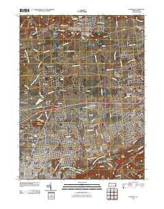
~ Nazareth PA topo map, 1:24000 scale, 7.5 X 7.5 Minute, Historical, 2010
Nazareth, Pennsylvania, USGS topographic map dated 2010.
Includes geographic coordinates (latitude and longitude). This topographic map is suitable for hiking, camping, and exploring, or framing it as a wall map.
Printed on-demand using high resolution imagery, on heavy weight and acid free paper, or alternatively on a variety of synthetic materials.
Topos available on paper, Waterproof, Poly, or Tyvek. Usually shipping rolled, unless combined with other folded maps in one order.
- Product Number: USGS-5220239
- Free digital map download (high-resolution, GeoPDF): Nazareth, Pennsylvania (file size: 13 MB)
- Map Size: please refer to the dimensions of the GeoPDF map above
- Weight (paper map): ca. 55 grams
- Map Type: POD USGS Topographic Map
- Map Series: US Topo
- Map Verison: Historical
- Cell ID: 31437
- Datum: North American Datum of 1983
- Map Projection: Transverse Mercator
- Map Cell Name: Nazareth
- Grid size: 7.5 X 7.5 Minute
- Date on map: 2010
- Map Scale: 1:24000
- Geographical region: Pennsylvania, United States
Neighboring Maps:
All neighboring USGS topo maps are available for sale online at a variety of scales.
Spatial coverage:
Topo map Nazareth, Pennsylvania, covers the geographical area associated the following places:
- Bethlehem - Tatamy - Newburg - Steuben - Hanoverville - Redington - Lime Ridge - Altonah - Lincoln Terrace - Middletown - Christian Springs - Steel City - Butztown - Welagamika (historical) - Bethlehem View - Mount Hope - Farmersville - Newburg Homes - Lincoln Park - Macada - Hecktown - Wagnerville - William Penn Manor - Bayard Park - Palmer Heights - Old Orchard - East Hills - Smoketown - Penn Allen - Georgetown - Tadmor - Freemansburg - Brodhead - Prospect Park - Walters - Nazareth - Hollo - Northwood Heights - Highland Park - New Centerville
- Map Area ID: AREA40.7540.625-75.375-75.25
- Northwest corner Lat/Long code: USGSNW40.75-75.375
- Northeast corner Lat/Long code: USGSNE40.75-75.25
- Southwest corner Lat/Long code: USGSSW40.625-75.375
- Southeast corner Lat/Long code: USGSSE40.625-75.25
- Northern map edge Latitude: 40.75
- Southern map edge Latitude: 40.625
- Western map edge Longitude: -75.375
- Eastern map edge Longitude: -75.25


