
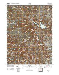
~ Media PA topo map, 1:24000 scale, 7.5 X 7.5 Minute, Historical, 2010
Media, Pennsylvania, USGS topographic map dated 2010.
Includes geographic coordinates (latitude and longitude). This topographic map is suitable for hiking, camping, and exploring, or framing it as a wall map.
Printed on-demand using high resolution imagery, on heavy weight and acid free paper, or alternatively on a variety of synthetic materials.
Topos available on paper, Waterproof, Poly, or Tyvek. Usually shipping rolled, unless combined with other folded maps in one order.
- Product Number: USGS-5218987
- Free digital map download (high-resolution, GeoPDF): Media, Pennsylvania (file size: 15 MB)
- Map Size: please refer to the dimensions of the GeoPDF map above
- Weight (paper map): ca. 55 grams
- Map Type: POD USGS Topographic Map
- Map Series: US Topo
- Map Verison: Historical
- Cell ID: 28647
- Datum: North American Datum of 1983
- Map Projection: Transverse Mercator
- Map Cell Name: Media
- Grid size: 7.5 X 7.5 Minute
- Date on map: 2010
- Map Scale: 1:24000
- Geographical region: Pennsylvania, United States
Neighboring Maps:
All neighboring USGS topo maps are available for sale online at a variety of scales.
Spatial coverage:
Topo map Media, Pennsylvania, covers the geographical area associated the following places:
- Riddlewood - Marple - Springton Point Estates - Lenni - Newtown Square - South Media - Coventry Crossing - Newtown Heights - Elwyn - Concord Chase - Bowling Green - Ivy Mills - Bridlebrook Estates - Runnymeade Farms - Concord Woods - Moylan-Rose Valley Station - Lima Estates - Willistown - Glen Mills - Geist Point - Willistown Hunt - Wawa - Balinahinch - Rose Tree Estates - Chester Heights - Central Square - Old Covered Bridge Estates - Larchmont Square - Springton Pointe Woods - Delchester Farm - Springton Pointe - Darling - Rose Run Estates - Alverno Valley Farms - Rose Tree - Moylan - Erin Rose - Jefferson West - Sycamore Woods Estates - Willistown Chase - Glen Riddle - Linvilla - Upper Providence - Lima - Springton Woods - Knowlton - Winderly - Village of Rose Tree - Radnor Hunt - Okehocking Hills - Deerfield Knoll - Castle Rock - Crum Creek Manor - Whitehorse - Victoria Wood - Penns Preserve at Willistown - Gradyville - Village of Valleybrook - Springton Chase - Worrell - Valley View - Mount Alverno - Willistown Knoll - Spring Oak - Pennell Place - Larchmont - Larchmont Meadows - Marplewood Villa - Woods at Sweetwater - Granite Run - Darlington Valley - Old Mill Pointe - Rochford Estates - Saint Albans - Edgemont - Florida Park - Plumsock - Providence - Eagleview - Crozierville - Media - Riddle Glen - Granite Farms Estates - Putman Village - Rockdale - Willistown Woods - Echo Valley - Sackville - Toft Woods - Blue Hill - Black Horse - Sycamore Mills - Rose Valley - Paxon Chase - Bortondale
- Map Area ID: AREA4039.875-75.5-75.375
- Northwest corner Lat/Long code: USGSNW40-75.5
- Northeast corner Lat/Long code: USGSNE40-75.375
- Southwest corner Lat/Long code: USGSSW39.875-75.5
- Southeast corner Lat/Long code: USGSSE39.875-75.375
- Northern map edge Latitude: 40
- Southern map edge Latitude: 39.875
- Western map edge Longitude: -75.5
- Eastern map edge Longitude: -75.375


