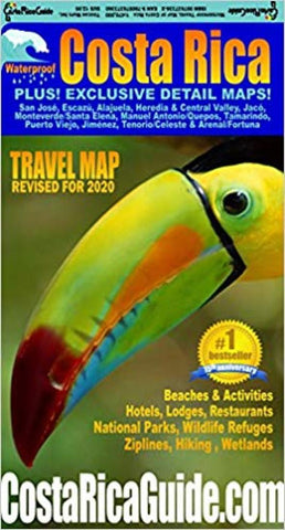
Costa Rica : waterproof : travel map : revised for 2020
Waterproof and rugged road and travel map of Costa Rica including zoomed detail maps of Arenal, Monteverde, Manuel Antonio and over a dozen other popular destinations. Roads are clearly differentiated by color and line width for classes from limited access divided highways down to 4WD seasonal tracks. Locations and easy to read indexes are included for cities and towns, National Parks and other natural areas, beaches, rivers, peaks, volcanoes, waterfalls and the best hotels, lodges, resorts, restaurants and activities.
The only street level map in print for the entire Central Valley from the International Airport to San Jose.
Detailed maps of Arenal Volcano/Fortuna, Alajuela, Escazu, Heredia, Manuel Antonio/Quepos, Monteverde/Santa Elena, Playa Jaco, Playa Tamarindo/Langosta, Puerto Jimenez & Tenorio/Celeste.
Proprietary symbols for distinctively Costa Rican attractions like zip-line and hanging bridge canopy tours, butterfly gardens, waterfall rappelling, rain
- Product Number: TOUCAN_CR_20
- Reference Product Number: 2344549M
- ISBN: 9780976373360
- Date of Publication: 6/1/2020
- Folded Size: 9.06 inches high by 5.12 inches wide
- Unfolded (flat) Size: 38.98 inches high by 26.38 inches wide
- Map format: Folded
- Map type: Trade Maps - Travel
- Geographical region: Costa Rica