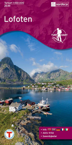
Lofoten 1:100,000 Topographic Map
Hiking map that covers: Austvgya, Ballstad, Eggum, Fiskebl, Flakstadya, Gimsya, Gravdal, Hadselya, Henningsvr, Hermannsdalstinden, Kabelvg, Laukvika, Leknes, Lofoten, Lofotodden, Melbu, Mosken, Moskenesya, Moskstraumen, Raftsundet, Ramberg, Reine, Rst, Skomvr, Skrova, Stamsund, Svolvr, Srland, Srvgen, Vestvgya, Vgakallen, Vrya, , ksfjorden Maps information Scale 1:100 000 Plastic material. (Tear and waterproof) Accommodation information (Cabins) Hiking trais Usefull hiking information for the area from the Norwegian trekking assosiation The National TurkartSeries from Nordeca (Walking maps) This collection of national walking maps consists of over 200 maps and covers the most popular walking and hiking areas of Norway. The maps are adapted for each specific area, and contain hiking trails, cabins and local touring information. The maps are available in the following scales 1:25 000, 1:50 000, 1:100 000.
- Product Number: NRD_LOFO_2549_17
- Reference Product Number: 2294120M
- ISBN: 7046660025499
- Date of Publication: 6/1/2017
- Folded Size: 8.27 inches high by 5.51 inches wide
- Unfolded (flat) Size: 27.56 inches high by 39.37 inches wide
- Map format: Folded
- Map type: Trade Maps - Physical
- Geographical region: Norway