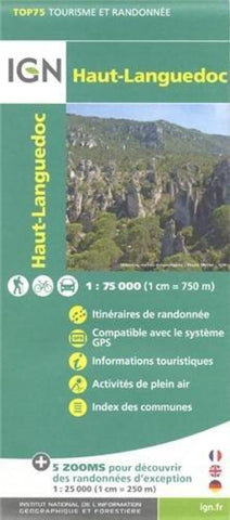
Haut-Languedoc, France 1:75,000
This GPS compatible, contoured topographic map shows at Haut-Languedoc at 1:75,000 scale. This map highlights local and long-distance hiking paths, cycling routes, and sites for other recreational activities. The sheet includes five large inset maps at 1:25,000 which cover its most popular areas in greater detail.
The 1:75,000 cartography is an enlargement of the mapping used in the IGNs 1:100,000 series. Contours are at 40m intervals, enhanced by relief shading; vegetation type is shown using additional coloring. Boundaries of national parks and other protected areas are marked. An overprint highlights long-distance GR hiking routes and cycling trails. Symbols indicate various places of interest including mountain refuges and gîtes detape, areas for other recreational pursuits such as climbing, hand gliding or water and winter sports, historic or cultural sites, etc. The maps have a UTM grid and an index of communes. Map legend includes English.
- Product Number: IGN75_22_12
- Reference Product Number: 2301118M
- ISBN: 9782758528999
- Date of Publication: 6/1/2012
- Folded Size: 9.84 inches high by 5.12 inches wide
- Unfolded (flat) Size: 46.46 inches high by 38.58 inches wide
- Map format: Folded
- Map type: Trade Maps - Hiking
- Geographical region: France

