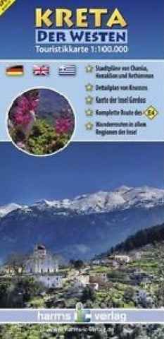
Kreta der westen : touristikkarte 1:100.000
The map shows the western half of the island up to Heraklion. It contains city maps of Chania, Heraklion and Rethymno, the three largest cities in western Crete area. A map of the island of Gavdos (with Cape Tripiti, the southern tip of Europe) is included as well as a plan of the historic site of Knossos. It provides a trilingual legend: German, English and Greek.
- Product Number: HV_CRETE_1_13
- Reference Product Number: 2213295M
- ISBN: 9783927468337
- Date of Publication: 6/1/2013
- Folded Size: 9.06 inches high by 4.33 inches wide
- Unfolded (flat) Size: 38.58 inches high by 26.77 inches wide
- Map format: Folded
- Map type: Trade Maps - Tourist
- Geographical region: Greece

