
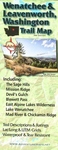
Wenatchee and Leavenworth, Washington, Trail Map by Adventure Maps
The Wenatchee & Leavenworth, WA Adventure Map is a waterproof, topographic map (lat/long,UTM grids) that includes route descriptions for the Wenatchee & Leavenworth area including, The Sage Hills, Mission Ridge, Devils Gulch, Blewett Pass, East Alpine Lakes Wilderness, Lake Wenatchee, Mad River and Chickamin Ridge. The map includes descriptions for 12 of the areas best mountain bike rides, 7 popular road bike rides, 11 hikes, and 8 X/C ski routes. Fishermen, hunters and OHV riders will also find this map very useful as it accurately shows all streams, lakes, roads, OHV routes and land ownership boundaries.
- Product Number: 2227314M
- Product Code: ADV_WEN_LEAV
- ISBN: 9781933783161
- Year of Publication: 2014
- Folded Size: 9.84 x 3.94 inches
- Unfolded Size: 38.58 x 26.57 inches
- Map type: Folded Map
- Geographical region: Washington


