Iraq, Classic, Sleeved by National Geographic Maps
Click to Zoom (high resolution)
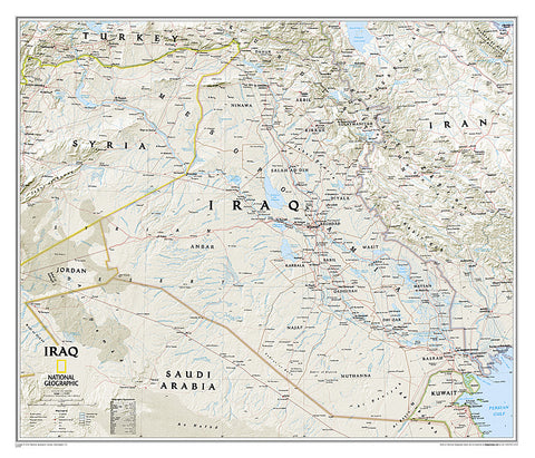
National Geographics Classic style map of Iraq is one of the most detailed and comprehensive maps available of this historic country in the heart of the Fertile Crescent. With its vivid color palette and accurate shaded relief, this wall map is as attractive as it is functional. Iraq is shown in its entirety along with bordering areas of Iran, Syria, Saudi Arabia, Kuwait, Jordan and Turkey. Hundreds of place names are displayed in an easy-to-read font in addition to cartographic patterns depicting deserts, lava fields, swamps, dry salt lakes and intermittent lakes. Major infrastructure networks such as highways, roads, aqueducts, canals, oil fields and pipelines, railroads and airports are also mapped.
- Product Number: 2165567M
- Product Code: NG_IRQ_WA_S
- Publisher Product ID: RE01020539
- ISBN: 9781597753654
- Year of Publication: 2010
- Unfolded Size: 25 x 21.06 inches
- Map type: Wall Map
- Geographical region: Iraq

