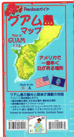
Guam U.S.A. Guide and Dive Map (Japanese edition) by Frankos Maps Ltd.
Text in Japanese augmented by English. Side 1 is a detailed map of the whole island of Guam. The island is shown in shaded relief so the viewer can see the island topography as it stands out like a beautiful emerald on descending hues of ocean blues, which represent the true depth contours of the surrounding North Pacific Ocean. Every hill and valley and the streams that flow out of the mountains to become Guam s numerous rivers can be visualized clearly. Side 2 includes two zoom-ins of Tumon Bay (the Hotel row area), and the area from Apra Harbor (lots of wrecks to scuba dive on) to Tumon Bay, which includes the scenic and historical capital of Agana (Hagatna in Chamorro). Side 2 also features a map of all of Magnificent Micronesia. The Micronesia map is surrounded by nine mini maps of Micronesia s most prominent islands. They include Northern Mariana Islands (Saipan, Tinian and Rota), Chuuk (Truk) Islands, Pohnpei Islands, Majuro and Arno Atolls of the Marshal Islands, Kosre, Yap Islands and Palau Islands. Pertinent visitors bureaus numbers are shown. Printed on durable, waterproof synthetic material. 18.5 x 26.5, folded to 4.5 x 9.
- Product Number: 2126621M
- Product Code: FM_GUAM_GDE_DIV_J
- ISBN: 9781601901002
- Year of Publication: 2011
- Folded Size: 8.66 x 4.72 inches
- Unfolded Size: 25.2 x 17.72 inches
- Map type: Folded Map
- Geographical region: Miscellaneous


