
Manhattan Buses and Streets by Tauranac Press
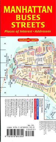
This map shows Manhattans streets and bus routes, updated to include all of the 2010 transit changes. To show the complex relationships between Manhattans public transportation system and the city it serves, mapmaker and graphic artist/architect John Tauranac has created three new individual maps - a subway map, a bus map, and a street map with places of interest - and he has mounted these back-to-back in three combinations. The maps are geographic and all to the same scale, and they all have the same grid coordinates for easy cross reference. These maps, just revised/printed this month, so all of the latest changes in the Manhattan subway system. The maps have an index of subway stops, shows hours of service at each stop, etc. The street maps show points of interest such as museums, concert halls, colleges, tourist attractions, etc. Sturdy paper, lightly laminated.
- Product Number: 2042424M
- Product Code: TAU_MAN_BUSSTR
- ISBN: 9781878892300
- Year of Publication: 2011
- Folded Size: 8.27 x 3.15 inches
- Unfolded Size: 25.2 x 6.89 inches
- Map type: Folded Map
- Geographical region: New York


