World, Explorer Executive, Tubed by National Geographic Maps
National Geographics World map is the standard by which all other reference maps are measured. The World map is meticulously researched and adheres to National Geographics convention of making independent, apolitical decisions based on extensive research using multiple authoritative source.
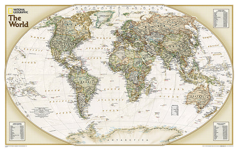
The Explorer Executive style World map uses a antique color palette, stunning shaded relief, and a subtle background grid pattern that echoes the cartographic precision that underlies all National Geographic maps. Drawn in the Winkel Tripel projection, distortions are minimized and unlike many other World maps, Greenland is show the same size as Argentina and not as the size of all of South America.
Thousands of place names are carefully and artistically placed on the map to maintain legibility even in the heavily populated ares of Europe, Asia and the Middle East. Details include clearly defined international boundaries, cities, physical features, rivers, and ocean floor features. Inset charts list the largest cities by population and the largest countries by land mass and population.
The map is packaged in a 2-diameter clear plastic tube. The tube has a decorative label showing a thumbnail of the map with dimensions and other pertinent information.
- Product Number: 2036899M
- Product Code: NG_WOR_E_EXP_WA
- Publisher Product ID: RE01020519
- ISBN: 9781597753456
- Year of Publication: 2014
- Unfolded Size: 16.93 x 28.74 inches
- Map type: Wall Map
- Geographical region: World

