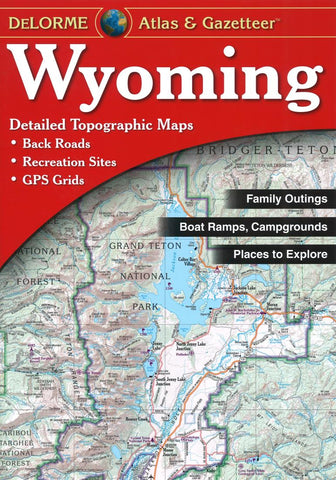
Wyoming, Atlas and Gazetteer by DeLorme
Rely on the Wyoming Atlas and Gazetteer for the utmost in trip planning and backcountry access. Contains topographic maps plus gazetteer information on great places to go and things to do. Scale equals 1:250,000 or 1=4 miles. Contour Interval is 300.Each page covers 38 miles x 51.8 miles and includes, GPS Grids and tick marks, placenames, and shaded relief. Special features in this atlas are a Yellowstone National Park Map and Gazetteer color coded BLM and state lands, and a Publicly owned lands locater map. 60 pages of maps, 72 pages in all. Gazetteer categories include Annual events, BLM public lands, Campgrounds, Dude and guest ranches, Fishing, Hiking, Historic sites/Museums, Hunting, Information centers, National lands, Scenic drives, Ski areas, State parks, and Unique natural features
- Product Number: 2035726
- Product Code: DELO_WY_AT
- ISBN: 9780899333380
- Year of Publication: 2014
- Map type: Atlas
- Geographical region: Wyoming