
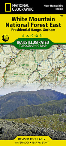
White Mountains National Forest, Presidential Range and Gorham, Map 741 by National Geographic Maps
Click to Zoom (high resolution)
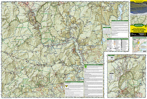
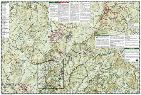
Waterproof, tear-resistant, topographic hiking map of eastern White Mountain Natl Forest.
Coverage area includes: White Mountain National Forest, Mt Washington, Tuckerman Ravine and Pinkham Notch, Dry River, Presidential Range; Great Gulf, and Caribou-Speckled Mountain Wilderness Areas. Appalachian National Scenic Trail: Crawford Notch State Park to Grafton Notch State Park, Maine. Moose Brook, Milan Hill State Parks. Berlin, Gorham, Jackson and North Chatham. Includes UTM grids for use with your GPS unit and a trail mileage matrix.
Map Scale = 1:70,000
- Product Number: 2034675M
- Product Code: TI_PRESIDENT
- Publisher Product ID: TI00000741
- ISBN: 9781566954181
- Year of Publication: 2011
- Folded Size: 9.45 x 4.33 inches
- Unfolded Size: 24.8 x 37.01 inches
- Map type: Folded Map
- Geographical region: United States


