

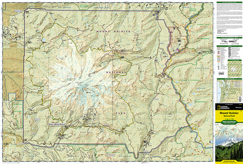
Mount Rainier National Park, Map 217 by National Geographic Maps
Click to Zoom (high resolution)
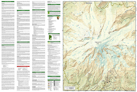
This Trails Illustrated topographic map is the most comprehensive recreational map for Washingtons Mount Rainier National Park. Within the park, there is detailed coverage of Mount Rainier and its many glaciers; Eagles Roost, Cataract Valley, Mystic, Emmons Overlook, Indian Bar, Maple Creek, Snow Lake, Paradise River, Jackson and many other camping areas are also included. A detailed inset gives you a close-up view of the peak and trails leading to its glaciers. This map is printed on waterproof, tear-resistant material, ideal for the outdoors.
- Product Number: 2034655M
- Product Code: TI_MT_RAINIER
- Publisher Product ID: TI00000217
- ISBN: 9781566953450
- Year of Publication: 2009
- Folded Size: 9.45 x 4.33 inches
- Unfolded Size: 24.8 x 33.07 inches
- Map type: Folded Map
- Geographical region: Washington


