
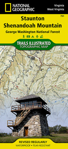
Staunton and Shenendoah Valley, Virginia, Map 791 by National Geographic Maps
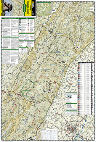
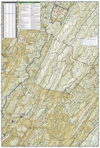
Printed on tear-resistant, waterproof material, this map is based on exact reproductions of USGS topographic map information, updated, customized, and enhanced to meet the unique features of each area. The map contains valuable wilderness tips and Leave No Trace guidelines, along with updated trails, trailheads, points of interest, campgrounds, and much more. With a new color palette and stunning shaded relief, backcountry navigation has never been easier.
This Trails Illustrated topographic map is a comprehensive recreational map for the Staunton/Shenandoah Mountain area of Virginia. Includes UTM grids for use with your GPS unit and a trail mileage matrix. Coverage includes: George Washington National Forest; the towns of Staunton and Warm Springs; Ramseys Draft Wilderness Area; the Todd Lake, Hidden Valley, Brandywine Lake, Hone Quarry, and Warm Springs recreation areas.
- Product Number: 2034651M
- Product Code: TI_VA_STAUNTO
- Publisher Product ID: TI00000791
- ISBN: 9781566953740
- Year of Publication: 2007
- Folded Size: 9.45 x 4.33 inches
- Unfolded Size: 37.2 x 25.2 inches
- Map type: Folded Map
- Geographical region: Virginia


