
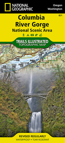
Columbia River Gorge National Scenic Area, Map 821 by National Geographic Maps
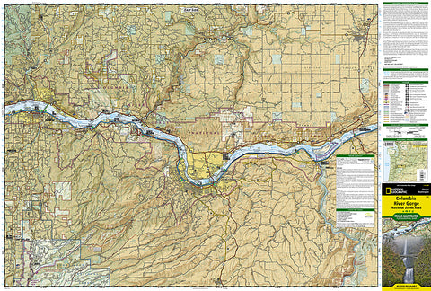
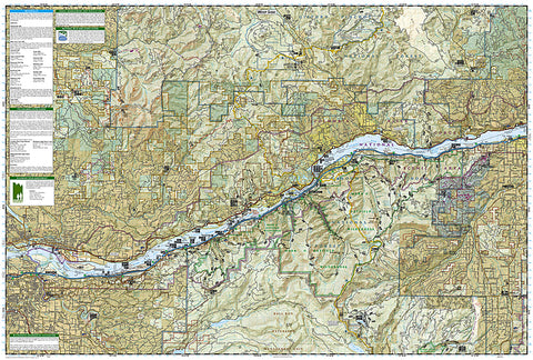
Click to Zoom (high resolution)
Waterproof, tear-resistant, topographic map of Columbia River Gorge, OR/WA.
This Trails IllustratedMap is a comprehensive recreational map. The 80-mile long gorge contains diverse ecosystems ranging from the lush Oneonta Gorge Rain Forest to the arid Celilo Grasslands.
Areas included on the map: Mark O. Hatfield Wilderness Area; White Salmon, Klickitat, Sandy, and Lower Deschutes Wild and Scenic Rivers; Pacific Crest and Oregon Trails; Mount Hood, Columbia River Gorge, Historic Columbia River Highway, and Yakima Scenic Byways; Hood River County Northwest OHV Area; National Wildlife Refuges; Washington and Oregon State and County Parks, and much more.
- Product Number: 2034615M
- Product Code: TI_COLUMBIA
- Publisher Product ID: TI00000821
- ISBN: 9781566954730
- Year of Publication: 2009
- Folded Size: 9.45 x 4.33 inches
- Unfolded Size: 24.8 x 37.01 inches
- Map type: Folded Map
- Geographical region: Oregon


