
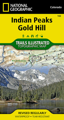
Indian Peaks and Gold Hill, Map 102 by National Geographic Maps
• Waterproof • Tear-Resistant • Topographic Map
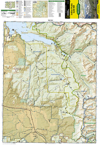
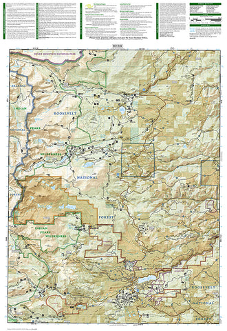
National Geographics Trails Illustrated map of Indian Peaks, Gold Hill combines unmatched detail with helpful information to offer an invaluable tool for enjoying the variety of recreation opportunities available in this section of the Rocky Mountains. Expertly researched and created in partnership with local land management agencies, this map features key points of interest including Indian Peaks Wilderness, Arapaho National Forest, Arapaho National Recreation Area, Gold Hill, Nederland, and the scenic Peak to Peak Highway.
With miles of mapped trails including the Continental Divide Trail, this map can guide you off the beaten path and back again in some of the most breathtaking scenery in Colorado. Cyclists will appreciate the detail paid to the many hard surface and mountain bike trails in the region. The map base includes contour lines and elevations for summits, passes and many lakes. Recreation features are clearly marked, including campgrounds, trailheads, snowshoe trails, fishing access, boat launches, and both alpine and cross country ski areas.
Every Trails Illustrated map is printed on Backcountry Tough waterproof, tear-resistant paper. A full UTM grid is printed on the map to aid with GPS navigation.
Other features found on this map include: Arapaho National Forest, Indian Peaks Wilderness, Lake Granby, Roosevelt National Forest.
- Product Number: 2034570M
- Product Code: TI_CO_102
- Publisher Product ID: TI00000102
- ISBN: 9781566952750
- Year of Publication: 2005
- Folded Size: 7.48 x 3.94 inches
- Unfolded Size: 25.98 x 20.47 inches
- Map type: Folded Map
- Geographical region: Colorado


