Afghanistan and Pakistan, Tubed by National Geographic Maps
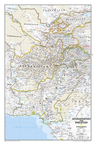
National Geographics map of Afghanistan and Pakistan is the most accurate and detailed reference map available for the region, covering these two countries as well as Tajikistan and parts of Turkmenistan, Uzbekistan, Kyrgyzstan, China, India and Iran. This Classic style wall map uses a bright and vibrant color palette and precise shaded relief, making it as attractive as it is educational. Accurate political boundaries are displayed on the map, including in the disputed area of Kashmir. Pinpointed are thousands of cities and towns, mountain ranges, national parks, glaciers, swamps, areas of sand, oil fields, highways and other roads, international and domestic airports, canals, railroads and waterways, including intermittent and dry salt lakes.
The map is packaged in a 2-diameter clear plastic tube. The tube has a decorative label showing a thumbnail of the map with dimensions and other pertinent information.
- Product Number: 2032641M
- Product Code: NG_AFG_PAK_WA
- Publisher Product ID: RE01020437
- ISBN: 9781597752640
- Year of Publication: 2010
- Unfolded Size: 27.95 x 16.93 inches
- Map type: Wall Map
- Geographical region: Pakistan

