
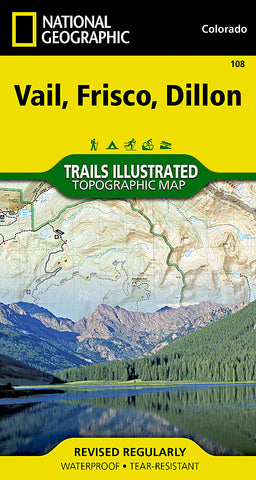


Vail, Frisco and Dillon, Colorado, Map 108 by National Geographic Maps
Click to Zoom (high resolution)
• Waterproof • Tear-Resistant • Topographic Map
Coverage includes the White River and Arapaho national forests, Eagles Nest and Ptarmigan Peak Wilderness areas, Redcliff, Minturn, Vail, Silverthorne and Frisco. Also includes the Dillon Reservoir, Eagle and Blue rivers, Willow Lakes, Tenmile Canyon National Recreation Area, Shrine, and the Vail, Silverthorne, Ptarmigan, Red Buffalo and Uneva passes. Ski Areas covered include Copper Mountain and Vail. 10th Mountain Huts: Shrine Mountain Inn. Portions of the Continental Divide Trail and Colorado Trail are also covered. Includes UTM grids for use with your GPS unit.
- Product Number: 2029314M
- Product Code: TI_CO_108
- Publisher Product ID: TI00000108
- ISBN: 9781566952811
- Year of Publication: 2013
- Folded Size: 7.48 x 3.94 inches
- Unfolded Size: 26.77 x 20.87 inches
- Map type: Folded Map
- Geographical region: Colorado


