
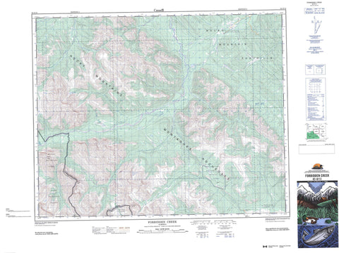
082O13 Forbidden Creek Canada topo map, 1:50,000 scale
082O13 Forbidden Creek NRCAN topographic map.
Includes UTM and GPS geographic coordinates (latitude and longitude). This 50k scale map is suitable for hiking, camping, and exploring, or you could frame it as a wall map.
Printed on-demand using high resolution, on heavy weight and acid free paper, or as an upgrade on a variety of synthetic materials.
Topos available on paper, Waterproof, Poly, or Tyvek. Usually shipping rolled, unless combined with other folded maps in one order.
- Product Number: NRCAN-082O13
- Parent Topo: TOPO-082O
- Map ID also known as: 082O13, 82O13
- Unfolded Size: Approximately 26" high by 36" wide
- Weight (paper map): ca. 55 grams
- Map Type: POD NRCAN Topographic Map
- Map Scale: 1:50,000
- Geographical region: Alberta, Canada
Neighboring Maps:
All neighboring Canadian topo maps are available for sale online at 1:50,000 scale.
Purchase the smaller scale map covering this area: Topo-082O
Spatial coverage:
Topo map sheet 082O13 Forbidden Creek covers the following places:
- Forbidden Lake - Lost Guide Lake - Condor Peak - Montagnes Rocheuses - Mount Peters - Ram Range - Rocky Mountain Foothills - Rocky Mountains - Tomahawk Mountain - Clearwater County - Municipal District of Clearwater No. 99 - Improvement District No. 9 - Banff National Park of Canada - Parc national du Canada Banff - Bighorn Creek - Clearwater River - Cutoff Creek - Forbidden Creek - Indianhead Creek - Lost Guide Creek - Peters Creek - Ram Creek - Ram River - Ranger Creek - Rocky Creek - Rum Punch Creek - Scalp Creek - Skeleton Creek - Timber Creek - Washout Creek - Divide Pass - Harrison Flats


