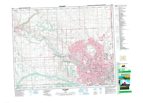
082O01 Calgary Canada topo map, 1:50,000 scale
082O01 Calgary NRCAN topographic map.
Includes UTM and GPS geographic coordinates (latitude and longitude). This 50k scale map is suitable for hiking, camping, and exploring, or you could frame it as a wall map.
Printed on-demand using high resolution, on heavy weight and acid free paper, or as an upgrade on a variety of synthetic materials.
Topos available on paper, Waterproof, Poly, or Tyvek. Usually shipping rolled, unless combined with other folded maps in one order.
- Product Number: NRCAN-082O01
- Parent Topo: TOPO-082O
- Map ID also known as: 082O01, 82O1, 82O01
- Unfolded Size: Approximately 26" high by 36" wide
- Weight (paper map): ca. 55 grams
- Map Type: POD NRCAN Topographic Map
- Map Scale: 1:50,000
- Geographical region: Alberta, Canada
Neighboring Maps:
All neighboring Canadian topo maps are available for sale online at 1:50,000 scale.
Purchase the smaller scale map covering this area: Topo-082O
Spatial coverage:
Topo map sheet 082O01 Calgary covers the following places:
- Calgary - Réserve indienne Sarcee 145 - Sarcee Indian Reserve 145 - Tsuu T'ina Nation 145 - Prince Island - St. Andrew Island - St. George Island - St. Patrick Island - Cochrane Lake - Glenbow Lake - Glenmore Reservoir - Big Hill - Cairn Hill - Nose Hill - Rocky Mountain Foothills - Spy Hill - Towers Ridge - Willindon Hill - Willingdon Hill - Municipal District of Rocky View No. 44 - Rocky View County - Big Hill Springs Provincial Park - Cochrane Ranche Provincial Historic Site (Developed) - Glenbow Ranch Provincial Park - Inglewood Bird Sanctuary - Refuge d'oiseaux d'Inglewood - Rev. George McDougall Provincial Historic Site (Undeveloped) - Beddington Creek - Beddington Creek - Bighill Creek - Bigspring Creek - Bow River - Cullen Creek - Elbow River - Harris Creek - Jumpingpound Creek - Lott Creek - May Creek - Millburn Creek - Nose Creek - Pirmez Creek - Springbank Creek - West Nose Creek - Cochrane - Altadore - Arbour Lake - Balzac - Banff Trail - Bankview - Bearspaw - Beddington - Beddington Heights - Bel-Aire - Bowness - Brentwood - Brickburn - Bridgeland - Britannia - Cambrian Heights - Capitol Hill - Chinatown - Christie Park - Cinnamon Hills - Citadel - Cliff Bungalow - Coach Hill - Connaught - Country Hills - Country Hills Village - Coventry Hills - Crescent Heights - Dalhousie - Discovery Ridge - Dover - East Springbank - Eau Claire - Edgemont - Elbow Park - Elboya - Erlton - Glamorgan - Glenbow - Glenbrook - Glencoe - Glendale - Greenview - Hamptons - Harvest Hills - Hawkwood - Hidden Valley - Highland Park - Highwood - Hillhurst - Huntington Hills - Inglewood - Keith - Lakeview - Lower Mount Royal - MacEwan - Manchester - Mayland Heights - Mission - Montgomery - Montgomery - Mount Pleasant - North Glenmore Park - North Haven - North Haven Upper - Ogden - Panorama Hills - Parkdale - Parkdale - Patterson - Pirmez Creek - Point McKay - Queens Park Village - Ramsay - Ranchlands - Renfrew - Richmond - Rideau Park - Robertson - Rocky Ridge - Rosemont - Rosscarrock - Roxboro - Royal Oak - Rutland Park - Sandstone Valley - Scarboro - Scenic Acres - Shaganappi - Signal Hill - Silver Springs - Simons Valley - South Calgary - Spruce Cliff - St. Andrews Heights - Strathcona Park - Sunalta - Sunnyside - Thorncliffe - Triwood - Tuscany - Tuxedo Park - University Heights - Upper Mount Royal - Valley Ridge - Varsity - Victoria Park - Vista Heights - West Hillhurst - Westgate - Wildwood - Windsor Park - Shannon Coulee

